
Our daily adventure log
Welcome to our blog! Join us as we journey from Ontario to the Arctic Ocean, sharing daily updates, exciting discoveries, and memorable moments. This is where our family and friends can follow our adventures, offering a fun, interesting, and informative look into our trip.
7 weeks in a DIY tin can...
0 travel experience.
Destination: The Arctic.
What could go wrong? 🥶🚐
Preparations underway...
The final countdown is officially on! 🗺️ With mid summer quickly approaching, our days are fully packed with intense preparation for an epic seven-week expedition across the Arctic Ocean. Packing for nearly two months in one of the most remote and unforgiving environments on Earth is no small feat. Every single detail matters when you are heading into the deep north in a tiny van. It is a whirlwind of logistics, spreadsheets, and anticipation, but the excitement is building every single day. Stay tuned—the ultimate across canada adventure kicks off soon! ❄️🚢
Day 1: Leaving Home & Heading North
August 8
What a massive, incredible first day to kick off our Arctic adventure! We officially hit the road early this morning at 7:00 AM. The sky started out heavy and cloudy, and by the time we drove into Parry Sound, the weather completely turned on us. We ended up driving through a torrential downpour that lasted for about an hour. Thankfully, the storm cleared right up after that, and the rest of the afternoon turned out to be beautiful and nice, with temperatures hovering around a comfortable 70°F.
Roadside Giants & Scenic Stops
Our first major stop was in Sudbury, where we pulled over to marvel at the iconic Big Nickel. We also stretched our legs inside Science North, though we decided to skip buying admission tickets this time around.
Back on the Trans-Canada Highway, we kept heading west until we hit Echo Bay. We pulled off to check out the world's largest Big Loonie (the Loon Dollar Monument). Right next to it, we took a lovely walk along the Lake Saint George boardwalk, which winds beautifully through the local wetlands.
Home for the Night: Lake Superior
After Echo Bay, we drove the final stretch to our home for the night: the Agawa Bay Campground inside Lake Superior Provincial Park.
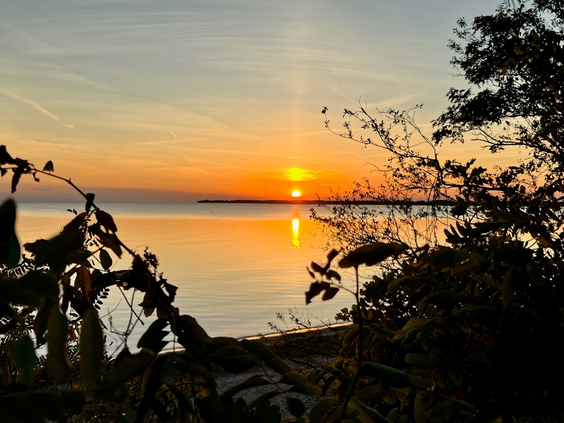
Our campsite is beautiful and sits right on the edge of Lake Superior. To wind down, we took a sunset walk along the beach and managed to snap some fantastic pictures. We just finished up a delicious supper, and now we are relaxing by a crackling campfire before finally retiring to the van for some well-deserved sleep. It was a long, busy day of driving, but the perfect start to this trip!
Day 2 - Lake Superior Provincial Park
August 9
Woke up to heavy grey skies today. Luckily, we managed to cook and enjoy a really good breakfast before the rain started coming down.
Since the weather was wet, we spent the morning resting and staying cozy inside the van. Around noon, we fueled up with some cranberry biscuits and warm oatmeal before heading out.
Once the rain cleared, we drove over to Sand River. We hiked the trail through the woods to a beautiful, rushing waterfall. After making it back to the van, we chased more views at a scenic lookout. Next, we drove to Agawa Rock to see the incredible, ancient Indigenous pictographs right on the cliff face.
We headed back to camp and grilled hamburgers for supper. Afterward, we attended a neat "Night at the Museum" event hosted by the park, complete with hot chocolate and snacks. To wrap up a packed day, we took one final, peaceful sunset stroll along the shore of Lake Superior.
Day 3 - Foggy Shores, Roadside Icons, and Falling Waters
August 10
Woke up at 6:30 AM to clear skies, a refreshing morning breeze, and a quick reminder that camp life always keeps you on your toes. The freezer had shut off overnight, meaning our first task was getting the power box charged up. Our grand plans for an electric breakfast quickly backfired when the kettle and omelette maker blew a breaker. Giving up on modern luxuries, we fired up the trusty little camp stove to cook our breakfast. After cleaning up and making sure the gear was fully powered, we hit the road around 8:00 AM, setting our sights on Kakabeca Falls.
Our route took us along the ruggedly beautiful Highway 17. The first major milestone was Wawa, where we pulled over to see the famous giant goose statue. From there, we pushed on to White River, stopping to pay a visit to the historic Winnie-the-Pooh monument. Back on the blacktop, the landscape turned industrial as we passed the massive Hemlo gold mine just east of Marathon, followed immediately by our first construction delay of the day.
As we rolled into Marathon, the sky turned a thick, eerie white. For a moment, we thought we were driving into forest fire smoke, but it turned out to be a wall of dense, freezing fog rolling off Lake Superior. We drove down to Pebble Beach to snap some photos. The lake itself was completely swallowed by the whiteout, but the wet, colorful shore rocks looked incredible in the mist.
The drive between Marathon and Terrace Bay was a dramatic stretch of massive hills and blinding patches of fog. We pulled over at a lookout to photograph an old rail bridge, though the fog only allowed us a ghostly glimpse of it. Further down the road, we took a break in Schreiber to explore a really cool train museum, before enduring another construction zone and pausing so Bruce could photograph a vintage truck.
The skies cleared up beautifully by the time we reached the Nipigon River Bridge. We climbed up to the fire lookout tower, capturing stunning panoramic views of the water. We caught up with Ryan, texted him some photos, and filled up the tank in Nipigon—paying a painful $1.89.9 per litre, the highest gas price of the trip so far.
As we neared Thunder Bay, we made a meaningful stop at the Terry Fox Monument under absolutely perfect weather. Finally, around 7:00 PM, we arrived at Kakabeca Falls Provincial Park. The waterfall is absolutely gorgeous, and we managed to get some incredible photos before the light faded. We tracked down our campsite, number 64—it is on the smaller side, but very cozy. After a long, exhausting day of driving and exploring, we whipped up some simple egg sandwiches, cleaned up the site, and crawled into bed. We are both completely wiped out.
Day 4 - Crossing Borders & Time Zones
August 11
Kakabeka Falls, ON to Falcon Beach Campground, MB
Distance Driven: ~530 km🌅
Morning: A Clear Start
Woke up around 7:00 AM to beautifully clear skies and a crisp, comfortable temperature. After a solid night of sleep, we fueled up with a warm breakfast of oatmeal, cleaned ourselves up, and took one final look at the majestic Kakabeka Falls. By 8:30 AM, our wheels were turning, and we were officially on the road heading toward Manitoba.🛣️
Afternoon: Forest Fires, Pricey Fuel, and the "Scenic" Route
Shortly after starting, our maps app flagged potential route delays due to local forest fires. We quickly passed a glaring neon emergency sign warning of limited access ahead, but thankfully, Highway 17 remained completely clear.Leaving Kakabeka, a sign explicitly warned us to check our fuel due to limited upcoming services. They weren't kidding—we passed an Esso station where gas hit a staggering $1.98 per litre, the steepest price we've encountered on the trip so far!As we tracked alongside the railway lines watching a massive train roll by, the highway threw a few unique moments our way:
The "Scenic" Detour
Right before Ignace, Ontario, we saw a sign for a scenic outlook. Having seen nothing but asphalt for miles, we eagerly pulled over. The spectacular view? Just a massive hill of dense trees. Not exactly postcard-material, but it gave us a good laugh!
Wildlife Watch
Spotted a tiny groundhog (or prairie dog) darting near the highway. It marks our first real wildlife sighting in three days, outside of a lonely partridge and what might have been a distant coyote.
The Time Warp
Around 400 km from the border, we crossed over into the Central Time Zone, gaining an hour of sunlight.
A Welcome Oasis & Manitoba Arrival
Just when we needed a break, we found a fantastic little coffee shop called Nowhere Craft Chocolate & Coffee Roastery in Vermilion Bay. Getting a fresh, house-roasted coffee was the perfect midday reset.Back on the road, we cruised past Kenora and caught our very first highway sign pointing toward Winnipeg. The driving conditions were absolutely flawless—flawless roads, perfect weather, and smooth sailing all the way to the provincial border. We officially crossed into Manitoba at 1:50 PM. Oddly enough, there wasn't a standard "Welcome to Manitoba" sign waiting for us, and the local travel center looked completely abandoned, so we pushed straight through to our final stop.⛺
Evening: Resort Vibes at Falcon Beach
We rolled into Falcon Beach Campground right at 2:00 PM. This place is massive and completely different from the rustic Ontario parks we've stayed at. It functions more like a bustling vacation resort, complete with its own grocery store, gas station, and shopping plaza.The campsites themselves are fairly wide open with minimal shade or privacy, but since it's just a one-night stop, we don't mind. The park features a beautiful beach, and the weather turned quite hot, so we kept dinner simple with some delicious butter chicken and bread. We capped off the night with a peaceful stroll through the resort grounds, treated ourselves to ice cream cones, and retreated to the van. We need all the rest we can get tonight—tomorrow is a massive haul with over 800 km of driving ahead of us!
Day 5 - Sunflowers, Wide Loads and Big Hospitality
August 12
We both slept incredibly well last night and were up at 6:00 AM. After brewing some morning coffee, we managed to hit the road right on time by 7:00 AM. Our first stop was for fuel at Falcon Beach. Gas was sitting at $1.80/L. Back on the highway, the skies cleared up completely after 7:15 AM. About 10 kilometres outside of Winnipeg, we drove past massive, endless acres of sunflowers lining both sides of the road. They are all just starting to bloom, and it looks absolutely beautiful. Shortly after, the sky turned a threatening gray, making us think we were driving straight into bad weather, but fortunately, nothing came of it. We managed to take the wrong exit on the Winnipeg Bypass, which sent us heading north instead of south. It wasn't a big deal, though, as it eventually looped us right back around. Just before 9:00 AM, we were back on Highway 1, but the traffic was heavy and slow. It was tedious stop-and-go driving with surprisingly frequent traffic lights for a major highway. To make matters worse, we got stuck behind a truck pulling an entire house that took up every single lane of the highway. We would never see anything like that back home in Ontario! As the landscape changed, we started seeing massive fields of corn, and we eventually drove past the flooding areas around Brandon, Manitoba.
By midday, I desperately needed a real coffee fix—instant coffee in the morning just isn't cutting it anymore—so we pulled into a Tim Hortons. Back on the road, we noticed a lot of industrial drills scattered across the landscape, though we weren't entirely sure if they were drilling for gas or oil. By noon, the skies were completely clear again, and we were closing in on the Saskatchewan border. We stopped for fuel one more time, which was a much more reasonable $1.62/L. We officially crossed into Saskatchewan just after lunch. Our first destination was Moosomin, where we dropped in on one of Bruce’s relatives. We had a quick visit before getting back on the road at 12:45 PM. Crossing another time zone and only about an hour and a half away from our final stop for the day, We decided to take a short detour into the little town of Wolseley to get some photos of the historic grain elevators. From there, we pushed through to our final destination: Moose Jaw. Just as we arrived at the visitor centre, the skies opened up and it started to rain. We braved the downpour anyway to snap a couple of quick pictures with Mac the Moose and the old military plane. After checking into our campground, we headed out to explore Moose Jaw. It is such a friendly little city. While we were grabbing burgers, two different locals came up to talk to us. One friendly guy kept us chatting for nearly an hour! We got back to the campground and settled in for the night. Tomorrow is going to be another massive day of driving, so we are turning in early to get some rest.
Day 6 - Resisting Temptations, Cows and Grain Bins
August 13
We woke up around 6:00 AM after a fantastic, restful sleep. We felt a massive wave of pride during breakfast. We were parked right next to a McDonald's, but we stayed strong and made oatmeal instead! 😅 By 8:00 AM, we were officially packed and on the road.
As we started driving down Highway 1, a thick, mysterious blanket of fog rolled in. It was so dense that we couldn't quite tell if it was heavy fog or wildfire smoke, but we suspect it was fog.
Mid-Morning: Lakes, Mines, and Long-Lost Relatives
- Chaplin: We passed a massive industrial mine operated by Saskatchewan Mining and Minerals. They extract sodium sulfate from Chaplin Lake, which sits right beside the highway. The lake looks like it had suffered a major flood at some point in the past.
- Morse: About 70 km east of Swift Current, we pulled into the tiny town of Morse to fuel up. We spotted a fascinating sign detailing the common birds of Reed Lake. The lake is right here, and it clearly serves as a massive magnet for local birdlife.
- Herbert: Next, we pulled into a town called Herbert. Who knows, maybe I have some long-lost relatives here! It features an incredibly cool grain bin, and we got lucky timing a photo of a train passing right by it. Right next door is the Herbert Stampede grounds, so I made sure to snap some great pictures.
By 11:00 AM, Bruce managed to get a few more shots of passing grain bins. Other than that, the view has been endless farmland and grazing cows, without a tree in sight. A light rain just started to sprinkle, but we have had great weather overall. Still no wildlife sightings yet.
Midday: Through the Rain to Medicine Hat
We rolled into Medicine Hat right around noon. The rain was steady, but the traffic was light and the roads were manageable. I took some time to chat with Brendan and catch up.
We eventually succumbed to the Golden Arches and stopped at a Medicine Hat McDonald's for a quick coffee break. Back on the road, the GPS showed we were just three hours away from Calgary.
Afternoon: Oil Fields and Arrival
The stretch between Medicine Hat and Calgary was filled with steady, heavy rain. The landscape is still quite flat, but the fields are absolutely packed with oil production infrastructure and active well-drilling rigs.
The heavy downpour finally tapered off into a light sprinkle when we were about an hour away from Jess’s place. Despite the lack of exotic wildlife, we have certainly seen thousands of cows today! We officially pulled up to Jess’s house at 3:50 PM.
Evening: Good Food & Great Company
After hanging out and catching up at the house, we headed out to Jane Bond BBQ for dinner. The food was absolutely incredible, and the portions were massive—we left completely stuffed!
After dinner, we got a wonderful driving tour of Calgary. We wrapped up the night back at the house, where I took a much-needed, blissful hot shower. We stayed up chatting and visiting until it was finally time for bed.
Day 7 - Good Company & Stunning Views
August 14
Our day started early with a wonderful sleep at Jess’s place. We were up by 6:00 AM, sipping coffee and enjoying a great visit with Jess until around 9:00 AM. Afterward, we all headed out to Denny’s for breakfast. Chelty joined us there around 10:30 AM for another hour of visiting. By 11:30 AM, we were finally on the road and setting our sights on Loop Brook Campground. The sky was cloudy but dry, leaving us hopeful that things would clear up by the time we reached Glacier National Park.
Midday: The Road to the Rockies
The journey officially began with a standstill. About 80 km outside of Banff, traffic ground to a halt due to construction. By noon, the foothills began to rise around us, and by 12:15 PM, the dense cloud cover completely hid the mountain peaks.
Around 12:30 PM, we rolled into Canmore. We took a break from driving to stretch our legs and manage to snap a few photos of the iconic Three Sisters mountains. By 1:30 PM, we were back on the highway and bypassing the town of Banff.
Afternoon: Turquoise Waters and Roadside Wonders
The drive quickly became breathtaking. We pulled off at a lookout before Lake Louise, capturing stunning shots of the turquoise water framed by the mountains. While there, a transport truck from United Transport passed by, hailing from Lindsay and Peterborough—a little reminder of home out here in the West.
We stopped at another lookout near Temple before Lake Louise, where we chatted with some travelers from Nova Scotia. By this point, the weather had turned absolute perfection; the sun was breaking through the clouds, hitting the mountainsides beautifully.
We tried to visit Lake Louise itself, but the parking lot was completely full and staff were turning vehicles away. We couldn't get close, but we did manage to capture a video of a gorgeous roadside waterfall on our way out.
Late Afternoon: Crossing the Border
At 3:15 PM, we officially crossed into British Columbia under bright, beautiful skies. Bruce celebrated the milestone by placing a sticker on the "Welcome to B.C." sign. Our next stop was the historic Spiral Tunnels, where we took photos of the railway tunnels. Traffic remained light and easy as we passed through Kicking Horse Pass and the town of Golden.
Just 5 km before our final turnoff, we hit one last stretch of construction, but nothing could spoil the view. Driving through Rogers Pass, the scenery was so magnificent we hardly knew where to look.
Evening: Settling into Glacier National Park
We finally arrived at Loop Brook Campground. It is a small, compact, but incredibly beautiful spot completely surrounded by massive mountain peaks. Right next to our site stand the historic giant stone train pillars where the railway used to run.
We have running water in the washrooms nearby, but no electricity. We are here until Monday, so we are keeping our fingers crossed that our battery boxes hold out until then. We cooked up chicken Burgers and noodles for supper. There's a grizzly in the area we are told so we're careful to clean up after ourself.
Between the driving and the time zone change, we are absolutely exhausted. The clock here says 8:00 PM, but our bodies feel like it is 11:00 PM. It has been an incredible, overwhelming day. I can hardly even grasp the scale of these mountains.
Good night.
Day 8 - Cozy Campsite, Helpful Staff and Glacier Hikes
August 15
Woke up at 6:00 AM to perfectly clear skies and stunning mountain views. Our campsite is incredibly peaceful, with the soothing sound of a running brook in the background. It truly is an amazing spot. We started our morning right by cooking up eggs, fried bologna, and toast for breakfast, paired with hot coffee.
After eating, we drove over to the Rogers Pass Discovery Centre. We initially tried to charge our power box using the car, but it was only at 50% and estimated a 5-hour charge time. Thankfully, the staff member inside the information center was incredibly kind and let us plug it into a wall outlet, which topped it off in just 40 minutes! While it charged, we walked a trail that led to an old, abandoned rail trail. It was an interesting interpretive park detailing the history of avalanches in the area. On the way back, we stayed on high alert for bears since warning signs are posted everywhere, and we even spotted some fresh evidence of them on the trail.
Once the power box was fully charged, we took a scenic drive to explore the area. We ended up at the Illecillewaet Campground for a fantastic long hike. We climbed up toward the historic Glacier House ruins and continued to the Meeting of the Waters. The trail started out quite steep but eventually leveled out into a really pleasant walk. The weather could not have been more perfect.
We headed back to camp for a quick lunch of Kraft Dinner and more coffee, then tidied up our site. Afterward, we took another stroll around the campground and did a small secondary hike. We brought the Insta360 camera along to try and capture some cool, creative shots of the little creek behind us and the massive stone pillars nearby.
By the time we got back, the morning's early start caught up to us, and we were both completely exhausted. We crashed for a much-needed nap and woke up refreshed around 4:30 PM. For supper, we made a cozy meal of chili and naan bread. After dinner, we brewed some warm turmeric tea and took one last evening stroll through the park, watching the sun dip beautifully behind the glacier. We even braved the freezing temperatures of our campsite's rushing stream to dip our feet in for a minute!
Between all the hiking, the freezing water, and the time change, I think we are going to sleep incredibly well tonight.
Day 9 - Quiet Morning, Quaint Towns, Relaxing Hot Spring
August 16
A brisk, 8°C morning woke us up around 7:00 AM after a great night of sleep. We enjoyed some quiet time and a warm breakfast before hitting the road toward Revelstoke later in the morning.
Revelstoke is a quaint, vibrant mountain town nestled right along the Columbia River. We explored the streets and ducked into Modern Bakeshop & Cafe for a coffee and a muffin. Afterward, we stopped by Home Hardware to pick up some bear spray ($67) to keep handy for our hikes. We then strolled through Centennial Park, a beautiful little spot stretching right along the waterfront.
On our way back toward the campground, we made a couple of fantastic stops in Mount Revelstoke National Park:
- Skunk Cabbage Boardwalk: A neat marshland trail where we spotted our very first bit of wildlife—a little garter snake.
- Giant Cedars Boardwalk: An incredible walk through massive, ancient trees where we captured some amazing photos.
By mid-afternoon, we stopped at Canyon Springs Hot Springs. The two pools offered a hot soak (104F) and a warm soak (86F) We soaked in the warm water for over an hour, which felt absolutely amazing after a few days on the move. We treated ourselves to ice cream and coffee before finally heading back to our campsite.
For dinner, we grilled up steak and rice. Once the camp was cleaned up and secured, we spent the rest of the evening just relaxing and enjoying the perfect weather. It is an early start tomorrow for an 8-hour drive over to Whistler, so we are turning in early tonight.
Good night.
Day 10 - Breathtaking Views, Windiest Roads, Olympic Vibe Town
We woke up at 6:00 AM to beautiful, clear blue skies. After a decent night’s sleep, we cooked a quick breakfast of oatmeal, packed up our site, and hit the road by 7:00 AM, heading toward our RV park in Whistler.
Around 8:00 AM, we watched a really cool train pass through a series of tunnels. We also bypassed a ghost town and the Enchanted Forest, keeping our eyes on the road since the weather was holding up beautifully. We made a quick pit stop at Fruit World in Sicamous to pick up some fresh fruit and use the washroom before jumping right back onto the highway. Next came a mandatory Tim Hortons stop for coffee and muffins as we rolled through Salmon Arm. The sign says the population is 19,000, but it feels like a much bigger city.
As we drove through Chase, the landscape began to shift. We could smell smoke from a recent fire, though we didn't run into active flames. Chase is a neat little town with a listed population of only 2,400, but like many places out here, it feels much larger. Moving closer to Kamloops, the trees vanished, replaced by an impressive trellis bridge and an arid, barren landscape that looks exactly like the badlands or rolling foothills. It turns out Kamloops sits in a semi-arid zone within the rain shadow of the Coast Mountains. The peaks block the moisture, creating a hot, sun-drenched environment for its 120,000 residents.
As we hit the intersection of Highways 97 and 99 to turn toward Whistler, the reality of the local wildfires became clear. We drove through thick smoke and passed a massive field of tents that we suspect belongs to the forest fire crews. After a gas stop and a quick break at a lookout, the scenery changed again around 12:45 PM. The hills grew larger, vegetation returned, and signs welcomed us into First Nations territory while warning of wild horses.
The drive between Lillooet and Whistler is spectacular but intense. We stopped at a few lookouts to photograph a breathtaking, rugged canyon with water rushing below it. The temperature climbed to a hot 30°C. Interestingly, we chatted with several travellers from Germany; it seems like a very popular route for international tourists.
We finally rolled into Pemberton around 4:10 PM, thoroughly exhausted from the tight hairpin turns and demanding roads. Looking up, we could see snow clinging to the mountain peaks. Desperate for a break, we pulled into a McDonald's for a quick meal and called Ryan to catch up.
Day 11 - Train Wrecks, Back Home Connections & Waterfalls
The day started at 7:00 AM with a hot shower, followed by a hearty breakfast of pancakes and sausages. By 9:00 AM, the campsite was clean, and the road was calling.
The next destination was Nairn Falls, but the parking lot was completely full. Pivoting quickly, the route led toward Pemberton with a stop at One Mile Lake—a beautiful, serene little spot.
The second attempt at Nairn Falls was a success, with plenty of open parking spaces. The 1.5-kilometre trail each way proved to be quite rugged and challenging, but the stunning views of the falls made every step worth it.
The evening was spent plugging in and charging up all the battery boxes in preparation for tomorrow's big transition. Tomorrow at 4:00 PM, a ferry awaits to take the journey over to Vancouver Island. The drive to the terminal is only 140 kilometres, but navigating the winding Sea to Sky Highway means it will take about three and a half hours.
Day 12 - Waterfalls, Ferry Rides, Squatters on our Site 🫨
August 19
Location: Campsite #10 (The Island)
What a day. It started in total peace and ended with a bit of an adrenaline rush, but we are finally settled into our van for the night.
Our alarm went off at 6:30 AM after a great night of sleep. Looking out, the sun was just breaking over the mountains into a stunning, clear blue sky. We got cleaned up, fueled up on some porridge, and made sure every single one of our battery boxes was topped up to 100%. We’re officially off-grid with no power for the next five days, so we're anxious and excited to see how our setup holds up!
We hit the road right on 8:00 AM. Our first detour was passing through Squamish to drop into Shannon Falls. It was incredibly tall and impressive, though there wasn't a whole lot of water coming off it this time of year. By 9:30 AM, we were cruising down the Sea to Sky Highway, stopping to snap photos of the massive cruise ships sitting in the bay.
About 10 km outside of West Vancouver, the city skyline finally came into view. Coming from the east, Vancouver feels a lot smaller and less overwhelming than Toronto, and the traffic was surprisingly light. The dashcam got some amazing shots as we crossed the bridges and spotted the massive cargo tankers floating out on the Pacific. Our GPS decided to take us on a scenic route through the suburbs and what felt like Chinatown, which was cool to see.
As we got closer to the ferry terminal, hunger struck. We pulled over at Harry's Fish & Chips for a 2-piece cod and fries for $18.95. The fries were excellent, and while the fish was a little bland, hey—that’s cod for you.
With time to spare, we drove down to Centennial Beach at Boundary Bay Park. This was a massive milestone for us: we walked down to the shoreline and put our feet in the Pacific Ocean for the very first time ever! It was a beautiful, unforgettable moment.
We left the beach a bit early and rolled into the ferry terminal around 2:00 PM. Even though they offered to bump us up to the 3:00 PM sailing, I opted to stick to our original 4:00 PM crossing to keep the early-bird discount I'd booked. We killed time wandering through the terminal's little market, treating ourselves to gelato and coffee, before hanging out in the van until boarding.
The crossing itself was flawless. The sun was shining bright, and while we didn't spot any orcas or marine mammals, the views of the passing ferries and the beautiful gulf islands were incredible.
We docked on the island at 5:30 PM, which is where the day took a weird turn. The GPS got confused and sent us in circles for a bit, but we eventually found the campground. When we pulled up to our reserved spot—Site #10—there was already a full setup there. It looked like squatters had taken over; they had two tents, trash everywhere, and a car bursting with random belongings.
Since there was no check-in office, we called the reservation helpline. The agent confirmed the site was ours and actually asked us to confront them while she stayed on the line, as the park ranger was off-duty until tomorrow. It was a little tense. The guy was cooperative enough, but the girl with the purple hair tried to argue that we had the wrong spot. We pointed right to the number on the post to prove it was ours. They slowly packed up, cramming everything into their car, and finally left. We actually felt a little bit sorry for them, but we paid for the site, and frankly, it is gorgeous—I can totally see why they tried to claim it.
Just as we were winding down, a park ranger happened to drive by. I flagged her down and explained what happened. She was amazing—she apologized profusely, cleaned up all the garbage the squatters left behind, and gave us an emergency number to call just in case they loop back tonight. She also asked me to email over the photos I took of their setup and license plate tomorrow morning, which I'll definitely do.
Now, we are finally sitting back, relaxing, and enjoying the view. We are here for two nights, and we're crossing our fingers for a quiet, uninterrupted night of sleep.
Good night!
Day 13 - Beautiful Victoria, Indian Food and Ocean breeze
August 20
Woke up at 7:00 AM to the morning sun peeking through the trees and hitting our campsite. It truly is a beautiful spot. We got up and made some oatmeal and coffee, trying to use up the last of our food supplies to get the morning going. After breakfast, we cleaned up and just sat for a while, enjoying the peaceful forest as the sunlight filtered through the branches. It’s been really, really nice—honestly, we’ve barely had any bugs the whole trip. The weather has cooperated so perfectly. Pemberton had a lot of flies for some reason, and when Bruce asked why, they told him it was because of all the local agriculture. But other than that, we haven’t had mosquitoes and we have zero bug bites, so things are going incredibly well.
We did have a little mishap this morning, though. The coffee grounds spilled inside the cabinet all over our power box, so absolutely everything had to come out. Luckily, we had a cleaning solution made of vinegar, water, eucalyptus oil, and a little bit of soap. The van got a really thorough cleaning because of it, and now she smells just like a spa!
By 9:00 AM, we were on our way to Victoria to check out the beautiful city. We’re off-grid for another three days, so we’re trying to charge the power box as we travel around. The display says it will take about three and a half hours to get a full charge back on her. I know Victoria isn’t actually that far away, but we’re hoping that with the drive there, the drive back, and a little touring here and there, it’ll be enough to keep our fridge running all night. We’re crossing our fingers that it works! We noticed gas prices around Vancouver and Vancouver Island have been around $2.10 to $2.11, but out here it’s $2.12 a litre, so it is pretty expensive.
When we arrived in Victoria, I was really glad to have Bruce driving. He is so used to city driving and stays so calm while looking for a parking spot. We lucked out and found a spot right down by the Breakwater District. There was a massive cruise ship docked there, so we got some cool pictures. We walked the breakwater—it's a massive structure built back in 1915 that stretches all the way out to a lighthouse at the end. It's quite a long walk out and back, but the day was stunning with a bright blue sky. As we walked, we saw seaplanes taking off (we figured they were tour planes for the cruise ship passengers) and we even saw people scuba diving right off the edge of the breakwater, which was really cool.
Brendan called while we were out there, so we got to chat and catch up with him for a while. I stopped by a little coffee shop to grab a coffee, and then we continued our walk into the downtown core. Victoria is just beautiful; we both really love it here. We popped into a few little shops, walked down Fan Tan Alley, and took a picture under the "Heart's Content" sign.
From there, we headed back up to the main road and stopped for lunch at an Indian restaurant called Varsha (Flavours of the World Rooted in India). Our host was incredibly friendly and stood talking with us for quite a while about India. I got a tandoori chicken wrap, Bruce got a shrimp and mango wrap, and we shared some masala fries. We also tried a plate of momos, but it was so much food that we couldn't finish them. We ended up packing them up, taking them back to the campsite, and having them for supper.
After lunch, we walked back to the van and took a scenic drive along West Saanich Road on our way back. We saw a monkey puzzle tree with stuffed monkeys hanging all over it. Did you know Victoria has little lizards scurrying around? We didnt so were surprised to see them on our walk by the waters edge. There was also an abundance of blackberries growing along there too so we each picked a handful. Bruce got a picture of a peach tree. Very lush area here.
We stopped at a few little parks along the coastline, including Moses Point, where we walked down to the water's edge before finally heading back to our campsite. It has been such a wonderful, full day. Now, I am pretty tired, so we’re going to call it a night. Just chilling out.
Good night!
Day 14 - Hidden Gems, Road to Tofino, Pacific Surfers
Day 15 - Pacific Trail Hikes, Touristy Tofino, Pacific Beaches
August 22
We slept in until 7:30 AM after a surprisingly peaceful night. The music stopped early, and we both woke up feeling well-rested. We started our morning with a homemade breakfast of omelettes, toast, and coffee. Before hitting the road, I took a hot shower in the outdoor showers. It was an amazing experience looking up at the towering cedar trees through the canopy while getting cleaned up.
Once ready, we drove into Ucluelet. Right away, we spotted two deer casually hanging out in someone's front yard. The town has a unique, laid-back, hippie-surfer vibe, and the road leads directly to the edge of the Pacific Ocean. Under cloudy, overcast skies, we decided to tackle the Lighthouse Loop Trail. It ended up taking about an hour and a half—longer than we expected—but the coastal views were incredible. We walked right along the cliffs and watched boats idling out on the water. While we didn't spot any humpbacks or whales, the scenery was beautiful, and the rain held off the entire time.
Back on the highway toward Tofino, Brendan called. He mentioned he had tried reaching us four times yesterday, but our cell service out here is incredibly spotty. We drove the long, winding road connecting the two towns. Tofino wasn't exactly what we expected; it was incredibly busy, commercial, and packed with tourists, and the waves weren't even that big. Finding a parking spot was impossible. We managed to pull into a marina wharf just long enough to snap a few pictures, but we had to keep the car running since parking signs were everywhere.
Frustrated by the crowds, we turned back toward Ucluelet. On the way, we pulled over at a little spot called the Wildside Grill for a poutine. Afterward, we grabbed a coffee and shared a muffin from a nearby bakery cafe. The outdoor seating area was swarming with crows. Despite the explicit signs warning people not to feed them, Bruce couldn't resist throwing them a piece of poutine, so naturally, they wouldn't leave us alone!
As we continued driving, we noticed that much of the coastline is blocked off by private resorts, making beach access difficult. We stopped at the Pacific Rim National Park Visitor Centre to look around, where we snapped a picture of Bruce next to an old Volkswagen and ended up chatting with a friendly American guy for about half an hour. By the time we left, it was already 2:15 PM.
Our next stop was the Radar Hill lookout, followed by a visit to Coombs Beach. The trek down to the shore was a long downhill hike via a series of old boardwalks that are definitely in need of repair. The beach itself had a rugged, moody beauty to it—quiet, uncrowded, and littered with massive piles of driftwood. Because it was low tide, the waves were low, allowing us to walk right up to the water's edge for some photos before tackling the grueling climb back up the hill to our car. The weather remained overcast with light, intermittent rain, but it didn't slow us down.
We wrapped up our afternoon by heading back into Ucluelet to explore a bit more. We drove around, walked down to a small marina, and realized we definitely prefer the quiet charm of Ucluelet over the hectic pace of Tofino. We shared an order of fresh fish and chips, uploaded some of our photos from the day, and finally pointed the car toward the campsite. It has been a really great, full day. Time to call it a night.
Good night!
Day 16 - Lazy Morning, Tofino, More Hikes
Day 17 - Cathedral Grove, Goats on the Roof & Beautiful Nanaimo
August 24
The vastness of this trip really started to sink in last night. Neither Bruce nor I slept well, mostly because it’s hard not to think about how far we are from home. We are truly out here.
Thankfully, we woke up around 6:30 AM to clear skies, comfortable weather, and the relief that our power box held up perfectly, sitting right at 50%. Skipping coffee and breakfast at camp, we just grabbed a quick coffee at the site's little restaurant and hit the road by 7:15 AM. The 89 km drive from Ucluelet to Port Alberni is incredibly scenic but incredibly twisty, keeping our pace slow and focused. We’ve officially gone as far west as we can; from here, the journey heads north.
We made it to Port Alberni by 8:30 AM and stopped at McDonald's for breakfast. The area felt a bit rough—a quick Google search confirmed it has about double the crime rate of a typical city in the Vancouver area—but it does have a beautiful harbor. Just outside of town, we saw a dead deer on the side of the road, a stark reminder of the wilderness out here.
Next up was Cathedral Grove, which was deeply impressive. Walking among trees that are 800 years old and towering way over 50 feet tall was incredible. We explored both the north and south ends, and I filmed a video with the Insta360 to upload to Facebook. From there, we hit Coombs to see the famous "Goats on the Roof." Honestly? A bit overrated. But the little market itself was excellent, packed with all kinds of unique foods, and we picked up a few things (and grabbed another Insta360 video, of course).
By 11:00 AM, we arrived at our campsite in Nanaimo. They let us check in early since it was empty, and wow, what a massive, welcome upgrade from our last site. It is beautiful here. After a quick walk around the camp trail, we headed down to check out the Nanaimo harbor. It was fascinating to watch people fishing for crabs using chicken drumsticks as bait. They drop the traps for 15 minutes, pull them up with three or four crabs inside, throw back the females, and measure the males to make sure they are big enough to keep. Between the crabbing and the floatplanes constantly taking off and landing, it’s a really cool harbor.
After a good phone call with Brendan, we grabbed donairs for lunch. They are completely different from the ones out East—these had Hickory Sticks inside and different sauces—but they were delicious.
We headed back to camp, parked, and walked down by the water. The weather is absolutely perfect—not a cloud in the sky, with views stretching out to the ocean and snow-capped mountains. People are paddleboarding, kids are swimming and laughing (loud, but a good kind of energy), and we even spotted what looked like little seals. Later, we walked to a little cafe near the campsite, bought ice cream, and ate it in a seating area right over the ocean. It’s wild to see the difference between the low tide when we arrived and the high tide now.
Now, it’s around supper time. We’re back at our site, sipping hot coffee, and just taking it all in. Our site overlooks the water, and with no neighbors on either side of us yet, it is deeply peaceful. Because we ate so much earlier today, we'll probably just have a light supper before heading to bed.
We are staying here tonight and tomorrow night, and then we have two nights at Michelle’s on Wednesday and Thursday. Tonight, we’re planning to sleep with the back door open to enjoy the cool air. Because we are facing east, we'll get to watch the sunrise tomorrow morning over the snow-capped mountains, the ferries passing by, and the big ships anchored in the harbor. There are even wild berries growing right along the back of our site.
Today was a perfect day. A much better campsite, a great rhythm, and overall good day.
Good Night
Check out the photos in the photo section
Day 18 - Living Forest Campsite, Piper's Lagoon, Paddling the Pacific
August 25
What a perfectly full, beautiful day.
I woke up just before 6:00 AM to a stunning pink sky stretching out right beyond the back of the van. We slept with the doors wide open all night; the temperature was absolutely perfect, and we both slept incredibly well. After snapping a quick picture of the sunrise, we crawled back under the covers for another hour and a half. By 7:30 AM, we were up, feeling refreshed after a nice hot shower, and ready for breakfast.
We enjoyed a special treat with our breakfast this morning thanks to the kindness of strangers. Last night right before bed, a young Italian couple with an 18-month-old baby pulled into the campsite next to us. We got to talking, and since they have to return their motorhome early and fly back to Italy, she asked if we could use some of their leftover food. They generously gifted us pasta, rice, sauce, potatoes, crackers, apples, and yogurt, completely refusing to take anything for it. So, alongside my coffee and oatmeal, and Bruce’s coffee, hash, and eggs, we happily enjoyed their yogurt.
With a cloudless sky, low tide framing the morning, and the weather forecast pointing to a hot 28°C, we decided to start with a lazy, slow morning. After Bruce caught up with Bob and I had a nice chat with Debbie, we took a recommendation to check out Piper’s Lagoon, which was a scenic 25 km drive from our campsite.
Before we explored, we looked up a bit of the history. It turns out it was originally called Page's Lagoon before the Piper family bought it in 1917 to farm (a venture cut short by cougar attacks on their livestock!). Long before that, it was a First Nations hunting ground, a whaling station in the early 1900s, and home to historic 1930s fishermen cabins on nearby Shack Island. We did a wonderful, long hike all around it, spotted a beautiful blue heron, and took a peaceful walk along the beach.
On the way back to the campsite, we strategically picked up takeout food for both lunch and supper so neither of us would have to lift a finger to cook in the afternoon heat. Back at camp, I had a great phone call with Ryan—it is always so wonderful to catch up and talk to your kids.
As the tide rolled in, we decided to seize the afternoon and rent a double kayak. We paddled way up the river into the cool, brackish water at high tide. We must have gone at least a mile up, and we had the most amazing companion—a curious little harbor seal that swam right along with us for a long way! We stayed out on the water for a couple of hours, completely lost in the moment.
Now, it’s just past 6:00 PM. We've finished our supper and I have my Keurig machine fired up in the van, feeling very modern and cozy. It was a hot, active day, so we are completely content just relaxing with our hot drinks. Bruce is eyeing the Nanaimo bar milkshakes at the little campground cafe, so we might just have to make a sweet treat run before the night ends.
Tomorrow we check out and hit the road to Courtenay to see Michelle and the family. But for tonight, we’re just going to enjoy a slow, quiet evening in the van.
Good night.
Day 19 - Parksville, Comox Valley, Great Company 🥰
Day 20 - Morning Visits, Hiking in a Downpour, Strolling with the deer
August 27
Woke up to gray skies and a rainy forecast. Roger got called into work for the morning, which actually turned out to be a nice chance to slow down. We spent the morning catching up on laundry and having a wonderful, long visit over breakfast. Blake headed off to work, and after lunch, Roger took us back out to do some more touring.
The skies were surprisingly clear when we left Comox. We grabbed a quick coffee for the road and pointed the car toward Campbell River. We kept our eyes peeled on the water hoping to spot some whales, but none of them decided to surface for us today.
As we approached the salmon hatchery, the skies opened up and it started raining heavily. We didn't let that stop us, though! We walked right out and got a fantastic first-hand view of the hatchery. We were keeping our fingers crossed to see a bear around there, but no luck—they probably had the sense to stay out of the downpour.
After squelching back to the car, we decided to keep the adventure going and drove up to Elk Falls. By this time, it wasn't just raining; it was absolutely pouring. Since we were already damp, we figured "why not?" and braved the trail anyway. The trek to the falls was worth it—the view was absolutely stunning. But wow, were we drenched! Two umbrellas did practically nothing to save us; you could have literally wrung out our clothes.
When we finally made it back to the car, we couldn't help but laugh at ourselves. We were a total mess with soaking wet clothes, dirty legs, and completely squelching feet. We drove home, peeled off our drenched gear, and ordered some delicious local pizza for supper.
To wrap up the evening, we took the dog for her evening stroll and ended up getting some great pictures of a few deer. Finished the night with some more good visiting before finally saying good night.
Day 21 - Hard Goodbyes, Further North, Bear Country
August 28, 2026
Morning: Goodbyes and Gray Skies
Woke up around 8:00 AM, showered, got cleaned up, and packed our things. Roger, Michelle, and Brea treated us to a wonderful breakfast with fresh coffee and muffins (Blake had already left for work). It was really special to spend that time together around the table before packing up the last of our gear, saying our goodbyes, and hitting the highway around 10:30 AM.
We stopped at Campbell River for gas and coffee before getting back onto Highway 19 toward Port Hardy. The road out here is incredibly remote with absolutely no services. Brendan tried calling and texting us, but our reception completely cut out, leaving us totally disconnected. We pulled into a rest area just to check it out under a heavy, gray sky.
Afternoon: Driving Through the Clouds
Around noon, a massive downpour hit us. Soon after, we began the long, gradual climb up Canyon hill, which took us right up into the thick of the clouds. On the way down, we took a quick break at Keta Lake rest stop. You could barely see the water through the thick trees, but Bruce got out to take a picture anyway.
The logging industry dominates the landscape up here; the mountains are heavily logged, and dense trees line both sides of the highway. Despite the heavy traffic, wildlife was scarce at first—just one deer. We also passed a car flipped over in a ditch, surrounded by police tape.
We drove past the tiny towns of Sayward and Woss (which has a nearby ski area) in the off-and-on rain. Cellular service finally kicked in as we approached Telegraph Cove, and by 3:00 PM, we checked into our resort. Our site is decent—right by the water with hydro and water hookups, though not very private.
Late Afternoon: Road Trips, Giant Burls, and Bear Sightings
We tried to go for a short walk, but it was cold and the sky opened up again. We retreated to the car and drove over to Port McNeill instead. It was the perfect rainy-day activity. We saw the world’s largest burl, took photos of the harbor, and grabbed a great dinner—Salisbury steak and fries for Bruce, sweet-and-sour pork with noodles for me, and a salad to share. While out, we also booked a 1:30 PM whale watching tour out of Telegraph Cove for tomorrow!
The rain got incredibly heavy on the drive back, causing severe puddling. Bruce had to deal with some intense hydroplaning just before we passed a sign warning us about the pooling water. We did a quick drive-through of Telegraph Cove but chose not to get out in the cold rain since we'll be back tomorrow. On the way out, we snapped a few cool photos of the local lumber mill, even though the smell was absolutely horrible.
Then, the wildlife luck completely changed! On the way back from Telegraph Cove, our first black bear crossed the road. We missed it on our phones, but the dashcam caught it all. Energized by the sighting, we took an 11.5-kilometre detour down a dirt road to a local recreation site. Sure enough, the dashcam caught a second, smaller black bear!
Evening: Clearing Skies and Spawning Salmon
The detour led us to the O'Connor Lake picnic area just as the mist was rolling down. On our way back up, the weather cleared beautifully. We captured stunning photos of the lake, the clouds reflecting perfectly on the water, and a little blue lumber shack. Right on the rocky edge of the road, we spotted our third bear, alongside two more deer. Our total for the day hit an impressive three deer and three bears by 7:00 PM!
As we made it back to the resort, the rain stopped completely, leaving behind a mix of clouds and beautiful blue sky. Right near our resort is Orca Sand & Gravel, the largest gravel and sand pit in the Northern Hemisphere. A massive conveyor belt stretches all the way from the pit to the water, where a giant cargo ship was being loaded. We can see the whole operation right from our campsite.
We went for a long, peaceful walk to end the day, taking pictures of the ship under a gorgeous evening sky. Along the way, we chatted with our campsite neighbors, who told us about a salmon spawning creek just up the road. We drove over and got incredible, clear photos of the salmon in the water.
Back at the site, the day treated us to a spectacular sunset. We are wrapping up the night perfectly: sitting by a warm campfire and roasting marshmallows, hoping for a clear sky tomorrow.
Good Night
Day 22 - Telegraph Cove, Whale Watching, Ocean Breeze
August 29
Woke up around 7:30 AM to gray, overcast skies. Thankfully, the rain held off. It was a crisp 12°C by the water, feeling a bit cooler with the coastal breeze, but we slept wonderfully and stayed perfectly warm through the night. After fueling up with a camp breakfast of oatmeal and eggs, we tidied up the campsite and hit the road by 10:30 AM, bound for Telegraph Cove. We wanted to leave ourselves some time to explore the historic cove before our whale-watching boat departed, keeping our fingers crossed that the dry weather would hold out.
We pulled into Telegraph Cove right around 11:00 AM, paid the $10 parking fee, and set out to explore. We grabbed a coffee and a muffin, sitting out on the wharf to soak in the morning air. While we were relaxing, Brendan called. Bruce stayed to chat with him on the phone, which gave me the perfect opportunity to grab the Insta360 camera and walk the length of the iconic wooden boardwalk. Right off the bat, we spotted a little sea otter swimming close by. Around 1:00 PM, the Princess of Wales returned to the dock, and by 1:20 PM, we were lining up to board.
Our three-hour tour set sail at 1:30 PM. Early into the cruise, we spotted another tiny sea otter floating casually on its back. The crew shared some fascinating history, explaining that sea otters are actually part of the weasel family. While they were reintroduced to Vancouver Island around 1970, they’ve only really started appearing in this specific area over the last five years.
From there, we cruised out into the deeper waters. The highlight of the trip was stopping to watch a beautiful humpback whale mother and her calf swimming together. We tracked a few more humpbacks throughout the afternoon, though the orcas we were secretly hoping to see never made an appearance. But that is the way nature goes! The wildlife viewing didn't disappoint, though—we caught sight of quick-moving porpoises, a majestic Bald Eagle, and an island packed with roaring male sea lions aggressively fighting for their place in their colony's hierarchy. The marine highway was busy today, too; we watched three massive cruise ships glide past, alongside plenty of local fishing boats and a Coast Guard vessel.
By the time we docked, the weather had turned out beautifully. It wasn't hot, but it stayed completely dry, and I'm confident we captured some incredible shots on the camera.
On the way back to our campsite, we stopped to fill up the gas tank. Back at camp, we fired up the stove to make chicken burgers and roasted potatoes for dinner, wrapping up the meal with a warm cup of turmeric tea. Once everything was packed away from the local wildlife, we carried our camp chairs right down to the ocean's edge. We sat back, watching the tide slowly pull out and looking across the water at the lighthouse opposite our site. The water is alive with movement tonight—dozens of little shapes dipping just below the surface, though it's too dark now to tell if they are small birds or curious seals.
It has been a full, rewarding day on the coast. Time to turn in, relax, and call it a night.
Good Night
Day 23 - Rainy Morning, Huson Caves, Flat Tires
August 30, 2026
The steady thrum of heavy rain during the night set the pace for today. We woke up to gray, rainy skies and happily leaned into a very slow, easy morning. We fueled up for the day with a simple breakfast—oatmeal for me, and peanut butter and Nutella wraps for Bruce.
Afterward, we tidied up the campsite and got ourselves cleaned up and ready for whatever the day had in store.
Based on a recommendation, we decided to check out Little Huson Caves Regional Park, located about 45 minutes away in the Nimpkish Valley. The information we found described it as a spectacular display of karst topography and limestone water erosion, famous for its accessible surface-level rock arches and emerald pools rather than deep, technical caves.
We headed out after lunch. The drive in was an adventure in itself—about 9 kilometres of rough, potholed dirt road covered in sharp river rocks. I was relieved when we made it through safely. Despite the rugged road, the parking lot was surprisingly packed.
The hike down to the caves was a bit of a trek, but completely worth it. The massive cave arches and crystal-clear water were stunning, and we spent a good chunk of time exploring and capturing some incredible photos.
Just as we returned to the trailhead, we ran into a young woman who was stranded with a flat tire and four kids. She was feeling completely lost and had no idea how to change it, so Bruce stepped in and offered to help. She was incredibly grateful. Bruce swapped out the tire for her, and with our good deed for the day done, we hit the bumpy road again around 2:00 PM. On the way back, we stopped at the Petro-Canada near our resort to give the vehicle a much-needed bath to wash off all that trail dust.
Back at the campsite, we cooked up a comforting dinner of hamburgers and roasted potatoes. Mother Nature put on quite a show for us tonight. First, a juvenile bald eagle flew right past us—it is staggering how massive those birds are up close. Later, while chatting with Ryan, we spotted two loons drifting peacefully out on the water.
The rain has been tapering on and off, but it is just a light, manageable mist now. We lucked out completely because it stayed totally dry for us during our hike. Tonight is all about relaxing. Tomorrow will be busy since we need to pack up camp, charge up our battery boxes, and make our way to Port Hardy. We sail out very early on Tuesday morning, so we are soaking up our final quiet evening here.
We capped off the day with the ultimate surprise: a pod of 4 orcas surfaced just off the beach while we were relaxing and winding down. 😃 we were only able to view 2 but we were glad to get the glimpse of them.
Good Night and thanks for following 😊
Day 24 - Leaving Camp, Grueling Hikes, Ferry Terminal Camping
August 31
Woke up around 7:00 AM and got straight to work preparing for the next leg of our adventure. We made breakfast—coffee, oatmeal, and eggs—and spent the morning doing prep work. Since we won't have power for the next two nights while we camp out at the ferry terminals in Port Hardy and Prince Rupert, we made sure all the battery boxes and electronics were completely charged up and our water supply was topped off. We cleaned up the campsite, cleaned ourselves up, and got ready to roll.
Right before leaving camp, we got a proper send-off from the local wildlife: a few little porpoises out in the water and a flying squirrel, which we’ve never seen around here before!
We headed off toward Port Hardy and stopped at a little rest area by the ferry terminal. We watched some seals playing in the water, then went over to a nearby bird sanctuary where we spotted both juvenile and full-grown bald eagles. From there, we went into the terminal to get organized. The worker was incredibly helpful—she got us our boarding passes and sorted out our overnight parking. We are parked in Lane 6, and since she told us we can come and go as we please, we decided to do some exploring.
We drove into Port Hardy, walked the boardwalk to snap a few pictures, and headed down the wharf to see the Coast Guard boats. While we were there, Bruce struck up a conversation with a guy working on a massive ship called Aqua Pharma. He explained that they take salmon out of the ocean, bring them onto the ship to de-lice them, and then sell them back to the salmon farms. It was fascinating to learn about.
Next, we took a drive out to Port Alice, which is a charming little oceanside town. It feels a bit higher-end than Port Hardy, with nicer yacht clubs and a tidier look. We stopped for lunch right by the ocean at a little local canteen. Bruce had poutine, I had a quesadilla, and we sat there for a long time chatting with Brendan and watching a harbor seal swim by. Just as we were leaving, a second seal showed up to say goodbye. On our way out of town, we even spotted a little deer hanging out on someone’s front lawn.
For our final big activity, we drove to Marble River Provincial Park to find the waterfall hike. It ended up being a grueling 5-kilometer trek (2.5 km in, 2.5 km out) with a lot of steep elevation changes and slippery sections. Knowing it was prime cougar and bear territory kept us on high alert. The falls was on the smaller side, likely due to the time of year, but fresh evidence of bears was seeing a half eaten salmon on the rock at the bottom of the falls. It was a tough hike and both of our bodies are really feeling it now, but it was the perfect, rewarding way to wrap up our time on Vancouver Island. We made it out in one piece, and the timing couldn't have been better; the skies held out for the entire hike, and the rain only started pouring down the second we hit the road.
Exhausted and happy to be out of the rain, we drove back into Port Hardy to find some dinner and treated ourselves to a much-deserved McDonald's for supper.
Now, we are settled into our parking spot at the Port Hardy ferry terminal for the night. Tomorrow morning we board the boat at 6:00 AM sharp to head out to Prince Rupert.
Good Night 😴
Day 25 - Inside Passage to Prince Rupert
September 1: Inside Passage to Prince Rupert
Rough morning, spectacular reward
We didn't get a great sleep last night. The terminal lights stayed blaring right through our windows, so it never got truly dark. Our alarms went off at 5:00 AM, but I stubbornly stayed in bed until 5:30. Once up, we dragged ourselves to the terminal washrooms to clean up and get ready for the day.
Boarding started around 6:30 AM, and by 7:30, we set sail. This spectacular route weaves right through the Inside Passage, surrounded by dense networks of emerald islands on both sides. Almost immediately, the water came alive—we spotted our first humpback whales around 8:45 AM! Because we chose not to book a private cabin, we claimed a cozy little public seating area to spend our day watching the small islands and quiet waters glide past.
Right as we started out, we passed a beautiful manned lighthouse on Balaklava Island. It's called the Scarlet Point Lighthouse, and it's actually one of only 25 remaining staffed lighthouses along the rugged British Columbia coastline.
We eventually migrated to another seating area near the tables and cafe. Breakfast at the cafe was quite the reality check—a hefty $40 for breakfast, though thankfully they do provide free water. Every so often, the ship's overhead announcement breaks the silence to allow passengers a strict 15-minute window to go down to the vehicle decks to grab whatever supplies they need.
Weaving through the wilderness
The boat continuously weaves its way through narrow gaps in the landscape. Some of the tiny islands are entirely empty; others host solitary towers or light stations. As we passed Calvert Island, I noticed a tower perched at the top. Though we had absolutely zero cell service or Wi-Fi out here, a random text message suddenly pinged through on my phone—our signal must have briefly bounced off that Calvert Island tower before dropping right back into the void, preventing me from replying. The sky remained a heavy, pretty gray with intermittant downpours. A special weather statement is active for Prince Rupert, warning of 24 hours of heavy rainfall ahead. It looks like we are in for a very interesting, wet night tonight.
Around 10:00 AM, the humpback whales put on a fantastic little show for us, breaching and splashing out in the grey waters, which was incredibly cool to watch. After they swam off, we gathered our things and relocated to a new seating area. By 10:50 AM, we passed the Hakai Conservancy, an incredible protected area. It holds a unique "tri-designation," managed collaboratively by two distinct First Nations—the Heiltsuk and Wuikinuxv—and the Province of BC. Just ten minutes later at 11:00 AM, we cruised past the Koeye (Kvai) River watershed. I learned that the Qqs Projects Society (pronounced "Cuks") runs an amazing cultural and youth science camp out here to connect youth with their ancestral lands.
The waters stayed mostly quiet, save for a few passing fishing boats. The gentle, rhythmic rocking of the ferry combined with last night’s lack of sleep completely zapped Bruce's energy—he couldn't stay awake and drifted right off. I must have slept better than I thought, because I found myself wide awake and captivated by the scenery.
An ancient ghost town
Next came Namu, a fascinating but eerie ghost town swallowed up by the temperate rainforest. It is actually the oldest continuously occupied site in Canada, with archaeological evidence dating human history back an astonishing 11,000 years! In the 1800s and 1900s, it became a bustling commercial fishing hub with a major salmon cannery, pushing the summer population up to 1,500 people. But the cannery burned down and closed in the 1960s, leaving it completely abandoned. In 1977, a Simon Fraser University archaeological excavation uncovered ancient human ancestral remains in the shell middens here, which were formally repatriated and reburied by the Heiltsuk Nation.
At 11:45 AM, we spotted yet another lone humpback whale just as we headed into the mouth of the Inside Passage by Hunter Island, right before the ship made its big, sweeping turn into the narrows.
For lunch, we treated ourselves to a cheeseburger and fries combo—another expensive onboard meal at $38, but it hit the spot!
Rain and temporary reception at Bella Bella
We pulled into the Bella Bella terminal around 12:30 PM. The skies completely opened up, sending down a hard, steady downpour. We managed to step out and snap a few quick photos in the drenching rain. Because we caught a sudden burst of cell signal at the terminal, Bruce was finally able to call Bob for the first time since we departed at 7:00 AM. I used the window of reception to fire off text updates to Brendan, Ryan, and Michelle.
Right by the Bella Bella terminal, we saw a local fish farm. It was incredibly cool to watch the fish actively jumping right out of the water! We pulled away from the Bella Bella dock at 1:45 PM and pointed our bow back out into the wilderness.
Not long after leaving, we ran into a few more humpbacks and passed a massive container barge being hauled by a sturdy tugboat.
Waterfalls in the narrows
By 4:15 PM, our wildlife tally grew by two more humpbacks and a lone seal. As we entered the incredibly narrow side passage flanking Sarah Island, the landscape transformed. Massive hills rose up on both sides, entirely covered in cascading waterfalls fueled by the heavy rains. Another humpback surfaced nearby. The ocean out here is heavily littered with stray wood debris; at one point, a giant floating log drifted past carrying a seal and six seagulls all hitching a ride together. It’s wild just how many waterfalls and logs are floating along this route. We've seen an incredible amount of humpbacks today, but by 5:30 PM, still no sign of any orcas.
They announced another 15-minute vehicle deck access, so I ran down to the vehicle to grab a few snacks and our device chargers. Because the windows are completely blurred with heavy raindrops and fog, taking clear photos from the inside is tough, and we were honestly too lazy to brave the cold, soaking outside deck. Even through the mist, the views are absolutely amazing. The fog is hanging light over the water, not too thick. Still, it is a very long ferry ride when the weather turns this rainy and grey.
As the evening wore on, the people sitting next to us asked if we’d mind watching their bags while they went to get dinner. We happily agreed, and once they returned, we took our turn to grab a bite. I had a warm plate of poutine and Bruce got the fish and chips. We moved to the opposite side of the boat to eat, only to discover that the waterfalls were just as numerous and spectacular on this side!
A midnight scramble
By 8:30 PM, the light completely faded and it grew dark. Brendan tried calling us, but the connection kept failing. Determined to speak to him, I climbed up to the exposed top deck of the ship into the wind and rain. It worked—I managed to get a fragile signal and talk to him for about 5 minutes before the service vanished back into the night. Cellular service out here is the definition of hit-or-miss.
We ended up making excellent time, arriving at the Prince Rupert terminal an hour ahead of schedule. However, because we were so early, we had to sit idle on the water and wait for the terminal staff to accommodate us. Finally, at midnight, they started calling passengers down to the decks—foot passengers first, then vehicles. We finally drove off the vessel's bow ramp around 12:30 AM.
Since we had been explicitly told there was absolutely no overnight parking allowed at the Prince Rupert terminal, we had to hunt for a spot in the pitch black. We drove a short distance down the road until we spotted a little roadside rest stop (Butze Rapids) off the highway where three or four other campers had already parked for the night. Relieved, we pulled in alongside them, set up the bed, and crashed. We both slept like logs.
Good night.
Day 26 - Family Ties, North to Alaska, Mezidian Provincial Park
September 2, 2026
Despite a terrible sleep last night parked between two other white vans, we somehow both woke up around 7:30 AM feeling refreshed and excited for the day. We cleaned ourselves up as best we could in the middle of the wilderness and hit the road to see my niece, Rosalie, in Terrace, B.C. Our speedometer sat at 6,780 km as we left our rest stop about 116 km away, putting us just an hour and twenty minutes from her place. We drove down Highway 16 towards Terrace. It’s a beautiful drive that hugs the Skeena River, surrounded by thick forests and mountains with waterfalls cascading down. A train line runs right alongside the highway for a long stretch, and we watched a train go by loaded with containers. The morning was foggy and cloudy, but the rain stayed mostly at bay—just a light, on-and-off drizzle. We rolled into Terrace around 9:00 AM, picked up Rose, and all piled into the van to treat ourselves to breakfast at Denny's. It was absolutely delicious. Rose had a clubhouse sandwich with fries, Bruce had chicken fried steak and eggs, and I had eggs, bacon, and crepes with fresh strawberries. Best of all, we finally got our first coffee of the morning. It was so special to see Rose after many years.
After dropping Rose back home, we knocked out a couple of loads of laundry, and Bruce used the time to upload all his pictures. Once the laundry was clean, we gave the van a really good scrub down, organized our things, and headed to Walmart to stock up for the next leg of our wilderness journey. We won't see another major town or grocery store until we reach Whitehorse, probably a week from now.
Reflecting on the trip so far, we both agreed that Terrace is a really nice spot. Prince Rupert was also a lot bigger than we anticipated, and its massive terminal quite surprised us. The weather has been on our side—some blue skies breaking through the clouds, and a comfortable temperature of around 15°C. The nights have been perfect too; we weren’t cold at all, and we definitely prefer it on the cooler side. Before officially leaving Terrace, we made a mandatory stop at Tim Hortons for one last "Timmys" fix, knowing there won't be another until the Yukon. We also made sure to fill up, noting that Terrace had some of the cheapest gas we’ve seen so far.
From there, we continued along Highway 16, following the beautiful Skeena River toward the Stewart-Cassiar Highway (Highway 37). The road was in great condition with very light traffic. About 40 km from the Cassiar, we hit a construction zone just as we passed a stunning, rushing river canyon with rapids. I wanted Bruce to stop, but with the construction traffic, it just wasn't possible. About 23 km before the Cassiar cutoff, we pulled into a lookout that offered a breathtaking view of the Skeena River against a backdrop of mountains. From a distance, we noticed a patch of trees that looked bright red. Getting closer, we realized it was the aftermath of a forest fire that had jumped the highway. Then, just 10 km before the highway split, we started noticing bright oranges in the trees—the fall colors are already starting to show. We made one last stop right before the junction at a modern rest area equipped with EV charging stations and free Wi-Fi.
Just a couple of kilometers before the turn, we passed a cute little farm with goats and other animals. We officially made it to Highway 37 and got a picture in front of the iconic "North to Alaska" sign by the Petro-Canada. While we still had cell service, we called Brendan. It was great to chat and catch up for a while until our signal completely cut out. Now, we are totally off the grid, heading north toward Meziadin Junction Provincial Park. The Cassiar Highway has been full of surprises. About 120 km from Meziadin Junction, we spotted our very first black bear of the highway and managed to get both photos and video. Not long after, we passed a tour bus, which surprised us since we didn't think they operated up here. The road is in much better shape than we ever expected—well-maintained, with the brush neatly cleared from the shoulders. We even passed a maintenance crew repainting the lines. Further up, we encountered a second bear. This one was a massive black bear right on the shoulder. We pulled over and I actually got out to snap a really incredible picture before a passing car spooked it back into the brush. Later on, we spotted a third bear just strolling down a gravel side road. The weather turned out absolutely flawless today. The sun broke through the clouds, pushing the temperature up to a beautiful 18°C. Along the way, we pulled over at an abandoned transport truck covered in graffiti, which made for a cool, gritty photo op.
We finally made it to our campsite and absolutely love it—we are parked right by the water. Bruce grilled up hamburgers, and we had them with a fresh salad for supper. Now, we are just unwinding and relaxing by the water. Life is good.
Good night!
Day 27 - Connected in Stewart, Ghost Towns in USA, Mind-blowing Glacier, Border Crossings
September 3, 2026
Woke up around 7:30 AM to perfectly blue skies. The temperature must have plummeted overnight because our windows were completely steamed up on the inside—definitely warmer in here than out there! We fueled up with a breakfast of oatmeal and eggs, shared a quiet moment together, and then cleaned up to hit the road.
By 9:30 AM, we were on our way to Stewart, BC. Connections are non-existent up this way, so it felt like we were truly off the grid. We pulled into Meziadin Junction to fill up the tank ($2.18/L for a total of $71) and scrub the windows so we wouldn’t miss a single view. And wow, what views. It is remarkably scenic here—just massive, snow-capped mountains everywhere.
The drive along the highway was absolutely mind-blowing. There are smaller glaciers tucked all along the route, with patches of snow sitting right at the base of the mountains. We drove past bear glacier..it was an impressive glacier. Beautiful, rushing glacial river flanked us, winding under and beside the road. Between the river and the massive waterfalls cascading down the mountain faces under a completely cloudless sky, I hardly knew where to look. We also noticed a lot of logging activity and a huge hydro project along the corridor as we approached town.
Amongst the towering snow-capped mountains, we paused to look up at a tiny house perched high on the hill, which we figure is an avalanche outpost given all the warning signs in the area.
We arrived in Stewart at 10:30 AM. It seems to have all the basics for food, and to our surprise, my phone lit up with five full bars of service!
From Stewart, we crossed over into Hyder, Alaska. It honestly feels like a ghost town. A lot of the buildings are completely run-down, and even the occupied ones are looking pretty rough. There are a couple of little shops open, but not much else. We drove through to the Fish Creek Observation Site boardwalk. We saw plenty of salmon splashing in the creek, but no bears on our first pass.
Next up was the drive to Salmon Glacier. The road up is incredibly rough and bouncy, winding past a massive gold mine, but it’s entirely passable. Reaching the summit was nothing short of an epic, mind-blowing moment for us. The day was so warm, the sky so blue, and the glacier itself is just massive. It is the fifth-largest glacier in Canada and the largest road-accessible glacier in the world! (Though you view it from the Alaskan side of the border, the glacier itself sits entirely in Canada). There were about ten other cars up there. We found a spot on the stone, made some coffee, and just sat there soaking it all in, surrounded by snow-dusted peaks. Truly an unforgettable day. After seeing salmon glacier, bear glacier paled in comparison but still impressive.
On the drive back down, we stopped at the Fish Creek wildlife platform one more time to see if any bears had cleared out the salmon, but still no luck.
We headed back through Canadian customs to get back into Canada and decided to follow Google's recommendation for dinner: the Silverado Cafe & Pizza Parlour in Stewart. I ordered a burger and Bruce got the fish and chips. While waiting for the food, we used the connection to update our blog and back up all of our pictures, knowing that once we leave here, we'll be completely without Wi-Fi for a while.
Tried calling Brendan and Ryan, but missed them both. Bruce got Bob so had an update from him.
Heading back to the campsite now to completely relax after a long, beautiful day.
Good night.
Day 28 - Emerald Lakes, Sunny Skies, Northern Lights
September 4
We woke up at 7:00 AM and got straight to work—charging up our battery boxes and fueling ourselves with a warm breakfast of oatmeal. After cleaning ourselves and the campsite up, we got on the road by 8:15 AM, stopping for gas at Meziadin Junction before setting off. Dease Lake was signed at 333 km ahead, but our destination lay even further down the line.
Over breakfast, our neighbor mentioned that people had spotted a grizzly bear swimming in our lake, and he’d actually seen it himself the day before! That built right on top of our incredible wildlife luck from last night: on our way back from dinner in Stewart, BC, we saw a black bear, then two grizzlies (a mama and her cub), and then another mama black bear with her cub who literally scaled the side of a cliff to get away from us. It was so cool to watch.
It turned out to be another gorgeous, sunny day with crisp blue skies—a perfect match for yesterday's weather.
Taking the Stewart-Cassiar Highway northbound past Meziadin Junction, the road was in surprisingly great shape. We immediately noticed how neatly mowed the ditches were, with a clear river running right alongside us. The trees are starting to shift into autumn—taller and skinnier near the tops, with warm splashes of orange peeking through the green.
By 9:00 AM, Bruce spotted our first black bear of the day, grazing right on the shoulder. We pulled over just twenty-five feet away, and it casually kept eating grass on Bruce's side of the vehicle while he snapped some fantastic pictures. Shortly after, near the sign for the Brucejack Mine, we passed a dead black bear on the roadside with a raven picking at it. We also caught a single bar of cell service right around there—just like our neighbor at the campsite predicted—though it wasn't enough to actually do anything.
Continuing on into the Tahltan territory, the road stayed smooth and easy for driving, though the roadside grass was left natural and unmowed here. We found a small rest stop to use the washroom, and just past it, we passed "The Last Frontier" lodge at Bell 2, which offers gas, food, and lodging.
Around Bob Quinn Lake, the highway got a little rougher, but remained paved and smooth. The road lines were mostly faded out, but active construction crews were busy rebuilding bridges and maintaining the route. Snowy mountain peaks framed the deep blue sky—just a breathtakingly scenic drive.
At 10:30 AM, we stopped to photograph rushing water beneath a bridge, then pulled into the Eastman Creek rest stop about 150 km out from Dease Lake. Barely any traffic out here, just a few other campers and the occasional transport truck enjoying the sunshine.
Past Kinaskin Lake Provincial Park, we got a chuckle out of the road signs: first "Livestock on Road," followed shortly by "Children on Road." Out here in the absolute middle of nowhere, we couldn't help but wonder where on earth those children or livestock would even come from! About 100 km from Dease, we pulled over at an impossibly pretty, unnamed lake where a few people were camping out to take pictures. The landscape gradually shifted to show a few more ranches, houses, and lodges, though it still felt deeply remote. The fall colors are slowly coming in—pops of red and orange, but nothing too dramatic yet.
About 70 km out from Dease Lake, the highway gave us a workout: a winding, 8% incline on pure gravel for about 500 meters. Shortly after, a sign warned us: "Caution: Caribou Next 30 km." The terrain transformed completely into rolling, shrubby hills with sparse trees and scattered kettle lakes. We kept our eyes peeled for caribou, but didn't catch any this time.
We finally rolled into Dease Lake and pulled into the Petro-Canada. I used the washroom, but the line for gas was backed up, so we decided to skip it. Dease Lake was completely different from what we imagined—just a small cluster of stores, a little restaurant, a health center, and a college campus. We'd hoped to grab Wi-Fi, but had zero connectivity, so we carried on by 12:48 PM toward Jade City.
Past Dease Lake, the road became narrow, winding, and steep, running alongside a stunning lake with fuller, lush trees. We passed a sign marking the Arctic Divide (definitely something we need to look up later!), then stretched our legs at the Rabid Grizzly rest stop, roughly 120 km from our final destination.
With warm, cloudless blue skies guiding us, we pulled into Jade City. We browsed the little shop, though the prices were eye-watering—$300 for a small carved jade duck and $150 for earrings! We settled on a cozy hoodie, a sticker, and a neat rock I picked up off the ground. Back on the road, a new sign alerted us to watch for mountain sheep over the next 30 km.
Sure enough, at Good Hope Lake, the view took our breath away. The water was a vibrant, brilliant emerald green set against sparsely treed hills. No mountain sheep in sight, but we grabbed some stunning photos before pushing through the final stretch.
At 3:30 PM—with 7,580 km logged on our journey so far—we finally arrived at Boya Lake Provincial Park!
BC Parks has a neat check-in system: you head straight to your site, where a paper tag displays your name, site number, and reservation dates, and the park ranger later swings by to check in. We scored Site 14, situated right on the water. Once settled, we cooked up a comforting dinner of pasta with homemade sauce.
After eating, I couldn't resist going for a dip in Boya Lake's famous waters. The lake itself wasn't freezing, but the bottom was bizarre—a silky, quicksand-like silt that sank me right up to my knees the moment I stepped in! It looked gorgeous, but felt so strange. I quickly washed my hair (probably shouldn't have in that silt, but it felt amazing to be clean!), hopped out, and warmed up with a fresh cup of coffee.
A friendly park ranger drove by selling firewood, so we stocked up for the night. She gave us a great tip: electric vehicle charging stations actually offer free Starlink Wi-Fi! We'll definitely have to test that out tomorrow.
We built a crackling fire and sat back to watch the sunset paint the surrounding hills and lake. Since our site faces east, we're in store for a beautiful sunrise tomorrow morning. We wrapped up the evening sipping hot tea, roasting s'mores by the fire, and soaking in the quiet. The ranger warned us that night temperatures drop quickly up here—it hit 4°C last night—so we're bundled up and ready for a chilly morning.
At about midnight we woke to a beautiful moon shining on the water and a light dusting of northern lights dancing low on the horizon. We braved the cold and crawled from our warm bed to capture some amazing night photos.
Good night!
Day 29 - Good Hope Wifi; Stuck On A Steep Slope!!; Stunning Mountain Sunset
September 5th
Woke up at 7:50 AM to brilliant blue skies and a crisp morning air—it dipped down to around 4°C last night, but we were super cozy in the van and slept like a log. We made a hearty breakfast of eggs, Spam, toast, and fresh coffee. Took our chairs right down to the water’s edge as the sun broke through, taking in the serene view over our morning brew. Perfect start to the day. A few brave souls nearby went in for a morning dip, while others were already out on the lake kayaking and paddleboarding.
Around 10:00 AM, we tidied up camp and brewed a second cup of coffee. On a park ranger’s tip, we took a short drive over to Good Hope Lake to see if we could catch Wi-Fi at the EV charging station via Starlink. We couldn't get the Starlink connection to work, but ended up getting great Wi-Fi through BC Hydro instead! We took full advantage: uploaded our latest blog post, sent off all our pictures, did some texting, and FaceTime’d Ryan, Brendan, Bob, Debbie, and Linda. It was so nice catching up with everyone—really glad we took the time to do it.
On the way back, as we drove past Good Hope Lake, we couldn't get over how gorgeous that emerald-green water looked. Spotting a small side trail heading down toward the shore, we decided to check it out... which turned out to be a bit of a mistake! The trail was ridiculously steep, bumpy, and full of deep potholes. We bounced our way down fine, but got completely stuck trying to climb back up. Panic set in for a minute—thinking about getting towed out when we're roughly 500 km from Whitehorse was extremely stressful! But we got to work, filled the worst of the deep holes with rocks, and Bruce put the van in low gear. Sure enough, the van bounced right up the hill with no problem. Massive sigh of relief.
We decided to just drive around for a bit to scan for mountain sheep or other wildlife. Right before the entrance to our provincial park, we hit the jackpot—a black bear right by the road! We stopped and snapped a ton of photos. It was completely unfazed by us, contentedly munching away on grass and berries.
After a short drive further up the road that didn't yield much else, we returned to camp for lunch. I whipped up a chicken stir-fry with rice, made another round of coffee, and we carried it all down to eat by the water. The temperature had warmed up into the 20s, and the lake was bustling with kayaks, paddleboards, and swimmers. I put on my bathing suit and finally braved the cold water myself (after scouting out a spot where my feet wouldn't sink into the bottom!). A quick dip was shockingly cold, but insanely refreshing. I also noticed a neat little natural spring bubbling up right near the shoreline.
After heading back up to clean the lunch dishes, we sat in the sun soaking up every bit of warmth we could. We know as we keep heading north, the days are only going to get cooler—and the nights downright freezing. In fact, a forum we've been following mentioned Tombstone Provincial Park got a light dusting of snow last night, so we’re mentally prepping for some true cold weather ahead.
Later in the afternoon, we set out on a 1.5 km interpretive trail nearby. It wound along the river and up into the forest, with signs explaining the local tree species and how ancient glaciers carved out the surrounding landscape. The area is home to bears, moose, caribou, lynx, and grizzlies—and naturally, while we brought a walking stick, we forgot our bear spray! To stay safe, we loudly sang songs through the woods (including a very enthusiastic rendition of "We All Live in a Yellow Submarine") and made it through unscathed.
On our way back through the day-use area, we discovered they rent canoes and kayaks right here! Had we known earlier, we definitely would have rented one today. If the weather holds tomorrow, renting a kayak to paddle the lake is priority number one. We're crossing our fingers for another sunny day before we pack up and head toward Whitehorse on Monday. Oh, and a little drama—someone was flying a drone around, and the park staff came by asking our neighbor if they knew who it was. Turns out it's a $350 fine!
For supper, we made noodles and treated ourselves to a can of lychees for dessert. The evening wrapped up with a breathtaking sunset—the reflection of the mountains and trees mirrored perfectly on the glass-like water. A bunch of campers gathered at the shoreline to shoot photos, and we got some incredible shots.
We capped off the night around the campfire until a few uninvited field mice decided to join our setup, at which point I promptly retreated to the safety of my bed!
Fingers crossed for good weather tomorrow.
Good Night
Day 30 - Restful Day, Angry Squirrels, Paddling Boya Lake
September 6
Woke up to another crisp, beautiful blue-sky day. Got up around 8:00 AM and cooked up a classic breakfast of bacon, eggs, coffee, and toast. After eating, we took our coffees down to the shore for a quiet, peaceful moment by the water.
Around 10:00 AM, we packed up and cleaned camp, washed the dishes, and drove over to Good Hope Lake to hop on the Wi-Fi. We managed to update the travel blog, text a few friends, and secure a reservation at an RV campground just outside the city limits in Whitehorse, where we plan to get an oil change for the van. On the drive back, we spotted a little fox again, though it slipped away before we could grab a photo!
Back at Boya Lake, we refilled our water jug and headed over to the rental spot to take a kayak out for two hours. Paddling around the pristine, crystal-clear waters was incredible. Boya Lake is one of the few lakes in northern British Columbia warm enough for swimming—well, "warm enough" in the sense that you won't get hypothermia, but gorgeous nonetheless!
After returning the kayak, we returned to the site to BBQ hamburgers and prep potatoes. We made potato ties with a couple of them and parboiled the rest to freeze for later meals. Our small battery box died last night, so we switched over to the big power pack, which should easily see us through until we hit the road tomorrow for our powered site in Whitehorse.
With the afternoon still ahead of us, we took advantage of the fine weather to hike the park’s other trail—a 1.5 km path hugging the shoreline. This time, we made sure to pack our bear spray. Along the way, we met an older couple from Powell River who were relieved to let us lead the way once they saw our bear spray! As we chatted, we were amazed to find out they actually know Roger’s family—it truly is a small world. We didn't spot any bears, but a few fiercely territorial squirrels gave us a proper scolding from their nests directly above our heads, looking like they were ready to pounce at any second.
By 4:00 PM, we were back at the site enjoying the lake's tranquility, watching seven or eight boats scattered across the water. We got to talking with a traveler from Arizona who came all the way up to northern BC for salmon fishing.
For supper, we cooked up trout and fried potatoes—absolutely delicious. Shortly after, the park ranger stopped by, frustrated about a drone flying in the park again, heading off to confront the campers she suspected were responsible.
While cleaning up, we struck up a conversation with our new neighbors next door. They just came down from Tombstone Territorial Park and warned us that the Dempster Highway road conditions were rough, with potential snow on the horizon. We’re bracing for the worst, but hoping for the best!
We lit the firepit and settled in, hoping for another spectacular sunset like last night's. When our neighbors returned from their walk, we swapped camper van tours—they’re traveling in a DIY RAM ProMaster 3500 build that felt super roomy inside, and they really liked the cabinetry setup in ours.
The sunset didn't quite live up to yesterday's vibrant show, but it was a lovely evening nonetheless. We packed all our outdoor gear away and called it an early night, ready for the big drive north tomorrow.
Good Night
Day 31 - A Desert in Yukon 😲! Historic Sites, Yukon River Canyons, Capital City of Whitehorse
September 7
Got up just after 6:00 AM and got straight to work. After making our coffee and oatmeal and getting ourselves squared away, we were on the road by 7:15 AM. We had 86 kilometers to go to reach the Alaska Highway, where we planned to grab gas before pushing on to Whitehorse, where we have a campground booked just on the outskirts for tonight.
The drive after Boya Lake toward the Alaska Highway was smooth. It’s actually a really good highway—especially considering everyone said the Cassiar Highway was in such rough shape. They’ve cut back the shoulder probably 200 feet on both sides for quite a distance. We even passed the Bush Hog that had done the clearing, though it was stopped when we saw it. Further along, we drove through a stretch where both sides of the road had been completely burnt.
Just about 30 kilometers from the Alaska Highway junction on the Cassiar, the landscape was filled with vibrant oranges. A major forest fire must have swept through here within the last five years; the old forest is gone, but the new growth is coming up strong—young trees mixed with tons of autumn oranges.
We officially arrived at the Yukon border right at the junction of the Alaska Highway and Cassiar Highway (Highway 37). We pulled over to put our travel stickers on both the BC and Yukon signs and snapped a few pictures. After refueling at the junction, we hit the Alaska Highway toward Whitehorse around 9:00 AM.
With about 450 kilometers ahead of us, we settled in for the drive. No big wildlife sightings yet this morning, but the scenery made up for it—flashes of red in the brush along the roadside and brilliant oranges everywhere. Cell service was completely hit-or-miss; pings came through occasionally, allowing us to receive a few texts, but we couldn't send anything out before dropping back into dead zones.
By 9:15 AM, the terrain started opening up with rolling hills and bright yellow foliage across the mountain ranges. Along the shoulders, there were clusters of pinkish-red shrubs and flowers set against the orange trees. We spotted a massive cell tower ahead and hoped for a connection, but passed right by it without a single bar.
By 9:30 AM, snow-capped mountains appeared in the distance. The weather was absolute perfection—crisp, cool, and beneath a clear blue sky. It was chilly when we started out, but it’s supposed to climb to around 16°C or 17°C today. Shortly after, we passed the sign for the Continental Divide (we had passed one for the Arctic Divide earlier in the trip—definitely something to look up once we have reliable internet!).
Around 10:10 AM, a welcome sign greeted us back into British Columbia, as the highway winds back and forth across the Yukon-BC border. Still no cell service, minimal traffic, and no wildlife sightings yet, but the drive remained smooth and easy going.
We pulled into the little town of Teslin around 11:15 AM to fill up on gas and grab a bite to eat. We stopped at the Yukon Motel, Gasbar & Restaurant, where Bruce had the two-piece Keith's fish and chips and I had a BLT with fries—simple, hot, and tasty. We grabbed fresh coffee to help wake us up and took advantage of the great cell service (a full 5 bars!). I caught up on messages with Brendan and Bob, uploaded a few of my photos, and mapped out our directions to Hi Country RV Park in Whitehorse.
We hit the road again around 12:30 PM. Along the way, we passed several signs prohibiting sheep hunting, so there must be mountain sheep in the surrounding peaks, though none showed themselves today.
At Jake's Corner / Johnson's Crossing, we noticed the turnoff for the Canol Road (marked as a scenic route toward Ross River). Right at the junction, there’s an outdoor display—almost like a graveyard of vintage construction vehicles and trucks—complete with interpretive signs explaining the history of the Canol Road project during WWII. We pulled over to stretch our legs, check out the old vehicles, use the washrooms, and take a few photos
.
At 2:00 PM, we took a planned detour off the Alaska Highway toward Carcross. Even before reaching the town, the view was incredible—the afternoon sun hitting the mountains as their autumn colors shifted was stunning.
Carcross itself was a highlight. It’s a charming historic town filled with unique shops, restored buildings, and a wide, beautiful beach. We strolled through town, walked along the cool (but not cold) shore, and grabbed a coffee at the Carcross Coffee Shop. From there, we drove over to the Carcross Desert—often called the smallest desert in the world. It’s actually a series of ancient sand dunes formed from the bed of a dried-up glacial lake. Walking along the sand dunes surrounded by northern mountains was a surreal experience.
Heading back toward the Alaska Highway, we made a quick stop at the Robinson Rediffusion / Robinson Station historic site.
About Robinson Station:
Located along the historic White Pass & Yukon Route railway line, Robinson Station served as a bustling siding, telegraph post, and supply point during the post-Klondike Gold Rush era (around 1906) when nearby copper and gold prospects were being developed. Today, the site features preserved log cabins, abandoned structures, and interpretive displays detailing the region's mining and railway history.
Before heading to our campground, we took a short detour to the Miles Canyon Viewpoint, and it was breathtaking. The Yukon River cuts through dramatic basalt rock canyons, rushing fast and cold in a striking shade of emerald green. With no guardrails along the sheer cliffs, looking straight down into the swirling water gives you a thrilling, slightly dizzying rush!
We checked into Hi Country RV Park around 5:30 PM. Our site has full power hookups, though it sits fairly close to the road, so we’re hoping traffic dies down overnight. For dinner, we whipped up a quick, comforting meal of perogies and sauce inside the rig.
After eating, we drove into Whitehorse (population around 28,000—small, but equipped with everything you need) to run a few errands. We swung by Walmart to restock a few supplies, then drove over to see the S.S. Klondike National Historic Site to snap a few photos of the historic sternwheeler lit up at dusk. Tomorrow morning, we're scheduled to get an oil change done on the vehicle before continuing the journey.
Now back at the campsite, we're putting away groceries and winding down. It’s chilly and overcast tonight with just patches of blue sky remaining, but we’re both thoroughly exhausted from a long, wonderful day of driving. Time for a good night's sleep!
Good night 😴
Day 32 - Oil Change, Museum Tours, Canyon Hikes
September 8
Woke up around 7:30 AM to gray skies and a brisk 8°C. Taking advantage of the facilities, we headed over for a nice hot shower before heading back to the campsite to cook up a full breakfast of oatmeal, bacon, and eggs.
Once breakfast was done and the site was cleaned up, we drove over to Jiffy Lube for a quick oil change on the vehicle, chatting with a few people while we waited. From there, we explored Whitehorse and visited the Yukon Beringia Interpretive Centre for a tour of the museum. We hoped to check out the Yukon Transportation Museum next, but it was closed for the week (open weekends only), though we still managed to snap a few pictures from the outside.
While we were there, Bruce struck up a conversation with a guy who had just returned from the Arctic Ocean. He strongly encouraged us to drive all the way to the end, but we’re still on the fence—we’re hoping to at least make it to the Arctic Circle, but word is the road conditions are getting rough and snow is already starting to fall up north. While they were chatting, I fired up the cookstove and whipped up some lunch: wraps, noodles, and fresh coffee.
After eating, we headed over to a park near the Yukon River and walked a trail that led to a fish ladder viewing spot near the power plant. There wasn't a whole lot running, but it was nice to be right along the river. Afterward, we took another scenic drive out to Miles Canyon.
Just as we arrived at Miles Canyon, a tour speedboat was powering through the canyon walls. It made three or four passes, giving us a great chance to grab photos and video. We then took a walk along the canyon trails, enjoying the views before heading off to fill up the gas tank to prep for tomorrow’s long haul to Dawson City.
Back at the campsite, we spent some time sorting through our food supply and meal planning. We fried up all our remaining hamburger meat for tacos tonight, prepping and freezing the leftovers for the road ahead.
Right before we finished cleaning up, the skies opened up. We had to rush through the dishes to beat the downpour, but managed to get everything packed away just in time.
Now we're safe and dry, sitting inside the van with the rain pouring down outside, relaxing and resting up for the big trip tomorrow.
Good night!
Day 33 - Alaska Highway, Notorious Dempster, Tombstone Campground
September 9
Woke up to a heavy downpour at 6:30 AM. Since we had a powered site, we skipped going outside in the rain and just used our Keurig for coffee and hot oatmeal. After getting fed, we cleaned up in the facilities and charged up the battery box.
Even with the pouring rain and gray skies, Whitehorse was packed with traffic—felt almost like Toronto rush hour. With a local population of only 28,000, it must be a peak mix of seasonal workers and tourists.
We hit Highway 2 toward Dawson City around 8:10 AM, immediately running into bridge construction. The rain was coming down hard, but Bruce managed to touch base with Bob around 8:20 AM since cell service was surprisingly solid just outside Whitehorse. We held off on calling Brendan or Ryan to let them sleep/work.
About 40 minutes out, the fall foliage really started popping—vibrant yellows and oranges everywhere. Passed a tractor bush-hogging the ditches; overall, the highway looked great. By 9:00 AM, the rain finally tapered off, opening up to brighter skies ahead. We drove through rolling hills with no cell service or internet left, so I pulled out the Milepost book to track our route. The colors on the hillsides are stunning—bright reds, yellows, and oranges mixed together.
Passed an "Elk Herd - Next 28 km" caution sign at 9:00 AM, though we didn't spot any. We pulled over for a quick washroom break near the Braeburn Fire of '98 site; the trail was a muddy mess, so we skipped the hike (will look it up online later). Stopped by the famous Braeburn Lodge hoping for one of their massive cinnamon buns, but it's closed for the season. Saw an airstrip right on a flat stretch alongside the road.
At Mile Marker 322.4, we stopped at the historic Montague Roadhouse site. Back in 1901, there were 52 of these roadhouses offering meals and lodging along the stagecoach route between Whitehorse and Dawson. Only two log structures remain here—one with a roof, one without. Nearby, you can clearly see the famous layer of white volcanic ash embedded in the banks along the roadside—remnants from an eruption 1,200 years ago that blanketed a third of the Yukon.
Shortly after, the road got ridiculously wavy and bumpy through a marshy section—we actually lifted all four wheels off the pavement! We survived the jump, and right in that wavy marsh, Bruce spotted two trumpeter swans.
Reached the small town of Carmacks (pop. 539) around 10:00 AM. Gas was $2.059/L, so Bruce filled up ($55) while I ran into the one-stop shop/grocery/deli for a coffee, bread, and hot dog buns. Crossed the steel bridge over the Yukon River at 10:23 AM.
At 10:45 AM, we pulled over at the Five Finger Rapids viewpoint. Named by early miners for the five channels formed by massive rock pillars, this stretch was a notorious navigation hazard where many lost their lives. We opted to admire the view from above rather than climbing down the 219 steps.
Continued past Pelly Crossing and Fort Selkirk—a historic 1852 post with 40 standing buildings from 1892, only accessible by boat 20 miles away. The highway narrowed back down with no shoulders, flanked by vivid red foliage and charred trees from past forest fires. We stopped at a viewpoint overlooking the Pelly River and bridge for a few photos.
Past Pelly Crossing, the road got rougher—dips, potholes, and a major gravel construction zone where we were held up waiting for a pilot vehicle. While stuck at 12:18 PM, we surprisingly picked up two bars of cell service in the middle of nowhere and called Brendan to check in. The escort truck arrived at 12:25 PM and guided us through a multi-kilometer stretch of road widening.
Finally hit pavement again at 12:40 PM near Stewart Crossing. Started raining again around 1:00 PM as we hit another long, wide stretch of hard-packed gravel under construction.
At 1:34 PM (134 km from Dawson City), we officially hit 9,000 km on the trip! Right around then, we spotted our first moose standing right by the side of the road—Bruce got some fantastic photos!
Stopped at the Tintina Trench Lookout. The panoramic view over miles of colorful autumn tundra, red rock, and stunted spruce was incredible. The sun finally broke through the clouds at 2:37 PM, lighting up the blues and vibrant autumn colors.
After another 25-minute construction delay at 2:40 PM, we made it to the Dempster Highway cutoff around 3:10 PM. We stopped at the gas bar/charging station, hooked up to Starlink, and texted the family to let them know we were pivoting: instead of going straight to Dawson, we'd tackle the Dempster Highway to Tombstone tonight!
About 13 km into the Dempster (around 3:30 PM), a passing van kicked up a rock and gave us our first windshield chip—hopefully it doesn't spread! The gravel road wasn't too bad—a bit washboardy, but we maintained a steady 65 km/h. The landscape became mind-blowing. Mountains looked practically on fire under the sunlight with intense reds and yellows. We had to keep stopping every few minutes just to take photos.
Crossed into Tombstone Territorial Park at 4:23 PM and pulled into the Interpretive Centre at 4:50 PM, just ten minutes before closing. The non-reservable campsite loops were full, but I hopped on the Wi-Fi and managed to snag the last online reservable site (#35) for $18!
Bruce fried up a hamburger and hot dog for dinner, and just as he finished, the rain poured down again. We retreated into the van to eat and clean up. Once the rain eased up at 7:45 PM, we walked over to drop our campsite registration tag in the box and use the washrooms.
It's overcast and drizzling off and on, but it was an incredible day. Tomorrow: driving up to the Arctic Circle!
Good Night
Day 34 - Defeated by the Dempster; Dredging up Dawson History, Campsite Ferry
September 10
When we went to bed last night, it was still light out—it took until almost 10:00 PM for the dark to finally settle in. We were holding out hope for the Northern Lights, but a heavy downpour dashed those dreams. There was no chance of catching a display through that wall of rain.
This morning greeted us with dense fog, heavy rain, and snow-capped mountains. The weather forecast is calling for heavy snow today and tomorrow, and the mud here is something else—slick as grease and clinging to absolutely everything, including our campsite.
When we woke up, Bruce thought we should abort and head back to Dawson City. I had been lying awake a bit through the night, listening to the rain and worrying, knowing a storm was brewing further up. Even in dry conditions, the Dempster Highway is a test of grit.
We both went into this trip with the mindset that we’d venture as far as it was safe. Getting to Tombstone was our main goal, while the Arctic Circle and the ocean were "thankful if we make it" bucket-list items. Safety was paramount. Looking at the weather now, I honestly don't know if we would have made the trek today, so I’m deeply grateful we pushed through yesterday. We got to see the mountains bathed in sunlight, which feels like a rare gift given today's relentless gray.
We made coffee and oatmeal, packed up, and left the campsite around 8:45 AM. As we were taking pictures on the way out, a Park Warden pulled over to check on us. She warned that it was snowing heavily at Kilometer 84, just above us. Right on cue, a tow truck passed by hauling two vehicles—one with a smashed windshield and another completely broken down. That confirmed it: we were making the right call to turn back.
As we headed off the Dempster, the contrast was wild. Behind us, everything was gray, wet, and snowy, but straight ahead, we could see patches of blue sky. The rain came and went, but we were driving toward better weather. We pulled over at one point hoping to fly the drone, but I couldn't log into the Potensic app—a classic downside of being out of internet range forever. No big deal, though; we’ll just have to capture the rest of this beauty with our eyes and regular cameras.
Past Tombstone, the road changed drastically—much drier, with far less washboarding and potholing. By the time we hit the flat stretches, the sun was hitting the hills and blue sky was opening up. The landscape feels so different once you get below Tombstone National Park. We spotted a number of grouse along the shoulders, though no big wildlife today other than yesterday's moose.
We pulled over at the official Dempster Highway sign for a few pictures. Talking to a few others, it sounds like plenty of people are pulling the plug on their northern drives due to the weather, so we’re definitely not alone in turning around.
About 30 kilometers outside of Dawson City, we passed a Manitoulin Transport truck that had gone off the road into a marsh. The road was paved there, so we figured the driver might have fallen asleep. A sobering reminder to stay sharp out here.
We rolled into Dawson City around 11:00 AM. After driving around a bit, we took the free six-minute ferry across the Yukon River to check out the campground on the other side. We secured Site #28 for the night for $20, then headed back into town to explore on foot.
Walking through Dawson feels like stepping into a living history book. It was born during the Klondike Gold Rush when gold was discovered on Bonanza Creek in August 1896 by Keish (Skookum Jim Mason), Shaaw Tláa (Kate Carmack), Káa Goox (Tagish Charley), and George Carmack. By 1898, over 100,000 stampeders had attempted the grueling journey north over the Chilkoot and White Passes, turning Dawson into the "Paris of the North." Its population exploded to 30,000, making it the largest Canadian city west of Winnipeg at the time. Today, it’s a vibrant, quirky town powered by heritage tourism, active placer gold mining, and a thriving arts scene.
After our self-guided walking tour, we stopped for lunch at Sourdough Joe's—a sandwich for me and classic fish and chips for Bruce.
With full bellies, we did a bit more walking about before deciding to head over to see the national historic site of dredge #4. Just as we arrived, the park employee was closing up so he gave us a quick briefing on the dredge.
Dredge No. 4 worked the Klondike Valley from 1913 until 1940. In 1941, the Yukon Consolidated Gold Corporation (YCGC) rebuilt the machine on Bonanza Creek using its original machinery and new timber. It continued operating there until November 1959, when rising labor costs, fixed gold prices, and depleted reserves forced its shutdown. Over its 46-year career, Dredge No. 4 extracted 9 tons of gold. Left in place on Bonanza Creek, it sank into the mud after a nearby dam collapsed in 1960. Parks Canada acquired the dredge in 1970, eventually excavating, refloating, and restoring it as a designated National Historic Site.
We spent the rest of the afternoon wandering the boardwalks and snapping photos of the historic buildings before heading back to our campsite to whip up a light snack and call it an early night.
Good Night
Day 35 Goodbye Dawson, Bears and Cubs, Yukon Camping
September 11, 2026
Our alarm went off at 6:30, but we refused to budge from the cozy sanctuary of our bed until 7:45. It dipped down to 5°C overnight, making our bed that delightful mix of warm covers and chilly morning air. Once we finally dragged ourselves up, we got right to it—made oatmeal, brewed fresh coffee, and cleaned everything up before hitting the road around 8:45.
While we had cell service, we made a few calls—Bruce called Bob, and I dialed up Diane. We had a bit of power management to sort out before rolling: our small battery box kept the fridge running all night, though it was down to 4% when we woke up. We got the fridge plugged directly into the car to keep it going while driving, and with our main battery sitting strong at 100%, we’re in great shape for tonight.
With that, we said goodbye to Dawson City and the Dempster Highway, officially beginning our long trek back southeast across Canada.
Almost as soon as we started, construction slowed us down. We were stopped at the Dempster Highway southbound junction at 9:48 by a flagger. The pilot car arrived around 10:02, and we were back on the move. By 10:10, we hit a stretch of very wide, rough gravel—the kind where you feel like you’ll go airborne if you take it too fast!
We pulled over at the Tintina Trench rest area again, which was well worth the stop. The trench extends for hundreds of miles across the Yukon and into Alaska—it's the largest fault line in North America and one of two major bird migration corridors in the territory. The views along the highway were stunning. The autumn colors are incredibly vibrant with rich oranges and warm hues—honestly, the colors feel even brighter coming back than they did on the way up.
Around 20 km from Stewart Crossing, we hit another gravel construction section, though thankfully there was no pilot car or waiting this time. We rolled into Stewart Crossing at 11:39, but hit construction again shortly after at 11:50. We took advantage of the stop to make pastrami sandwiches for lunch right in the van. The wait was surprisingly short—we were back on the move by 11:54, a vast improvement over the 25-minute delay we had here last time! Driving through, we could see evidence of a recent forest fire on both sides of the road.
We made it through the main construction zone by 12:07, but the gravel didn't end when the pilot car let us off. We spent another five minutes kicking up clouds of thick dust behind a massive transport truck before finally hitting smooth pavement again at 12:12.
By early afternoon, the day had turned gorgeous—pure blue skies and around 18°C. We stopped at Pelly Crossing at 12:45 to fuel up and grab some fresh coffee hitting the road again by 1:00.
Around 1:45, we pulled into the Five Finger Rapids Recreation Site. It was absolute perfection out, 20°C, brilliant sunshine, and not a single cloud in the sky. We snapped some pictures of the stunning view. Bruce struck up a conversation with a traveler from Brazil who was on a mind-boggling trip with his wife and three daughters (the oldest being just eight!). They started all the way down in Brazil, drove to Patagonia, traveled all the way up to Prudhoe Bay and akso did the Dempster, and are now making their way south again. What an incredible journey for a young family!
As we were coming into Carmacks, we got a huge treat: a mother black bear with three cubs right on the side of the road! We stopped and watched as she safely escorted her three little ones across the highway. We managed to capture some amazing photos and video.
Once in Carmacks, we grabbed a quick picture of the Carmacks sign, called Brendan to send him the bear video, and pulled out at 2:20.
About 70 km outside Whitehorse, we noticed the trees aren't quite as far along in their fall colors as they were further north—there's still a lot more green mixed in with the yellow, but it’s still remarkably pretty under the clear blue sky. About 30 km out, we spotted the mountain peaks we had passed a few days ago. They now have a fresh dusting of snow on top—looks like they caught a bit of that crisp Dempster weather after we left!
During the drive, I managed to get ahold of Liard Hot Springs and successfully book an electrical site (#21) for tomorrow night. We are both really looking forward to a long soak in the thermal pools after all these kilometers!
We got gas as we approached Whitehorse, about 15 minutes out from our campground. We pulled into Wolf Creek Campground—a nice Yukon government campground just east of town—right at 4:30 PM. The odometer read 9,898 km when we put the van in park.
We stretched our legs with a lovely 1 km hike through the woods before cooking dinner of trout, rice and charred corn. Finally settling in around a crackling campfire, and winding down for the night.
Tomorrow brings another big driving day—630 km to Liard Hot Springs!
Good night 😴
Day 36 Bears, Bison & Hot Springs 🔥
September 12
It dropped down to 1°C last night, but we stayed plenty cozy in bed. The alarm went off at 6:30 AM, so we got up, cut up some fruit, got coffee brewing, and made oatmeal before hitting the road at 7:30 AM on our way to Liard Hot Springs.
Usually, I don't have to deal with the sun in my eyes in the morning, but here we were, heading east into the morning sun with our sunglasses on at 7:30. It was a pretty clear day with a pale sky and a few clouds. Just outside the campground on the Alaska Highway, we stopped to take a picture of a bridge shrouded in fog—it looked so cool, with magpies flying all around.
Around 8:10 AM, we spotted a grizzly bear on the side of the road! He was chowing down on something and refused to look up at us, even after we tried beeping the horn. Still, he was interesting to look at, and we managed to get a couple of pictures of his hind end.
Continuing east on the Alaska Highway, the lowest-lying areas looked white with frost. As we began climbing up into the mountains, we hit what looked like a solid wall of fog—it felt like we were driving right through the clouds. Visibility dropped to maybe 250 feet in front of us. We had no idea where the fog came from since we had just been under blue skies, and it was so dense even the sun couldn't penetrate it. We were just hoping nothing jumped out in front of us since we couldn't see very far!
Around 8:45 AM, we officially hit the 10,000 km mark on the trip. Shortly after, Bruce noticed this morning that we picked up another chip in the windshield—low down on the driver's side. That makes two chips now, but at least we haven't hit five, so that's a win!
At 8:50 AM, we stopped in Teslin for gas and coffee. Bruce called Bob and I texted Ryan. By then, the fog had completely cleared and it was sunny again.
The Alaska Highway weaves back and forth across the border between Yukon and British Columbia—the sign says you cross it seven times! We passed a recreation site called Rancheria Falls, which I had highlighted in my book to do the walk. Even though there was danger tape all around the entrance, we saw another couple head in, so we decided to check it out anyway. When we got to the boardwalk, it was completely boarded off and had collapsed, so we couldn't make it all the way to the falls. Still, it was great to stretch our legs and get a walk in. Driving around Rancheria, I noticed the mountains here have snow on their peaks; they seem to be getting much higher. Just past the Rancheria River bridge, I spotted a big bald eagle.
Just after 10:00 AM, we passed the Cassier Highway (Highway 37) junction where it meets the Alaska Highway. Now we're on a southbound stretch of the Alaska Highway that we've never been on before, heading toward Watson Lake just 20 km away.
On the way into town, we came across the exact same guy pushing a carriage that I had taken a picture of back on Monday! Here he was, still walking south along the Alaska Highway near Watson Lake. I don't know how long he's been at it, but he's certainly been logging the miles.
We stopped in Watson Lake and visited the Northern Lights Centre / Visitor Information Centre. The lady inside was wonderfully helpful and friendly, giving us a lot of tips for the next leg of our drive. She warned us that this stretch is a major wildlife corridor, so we were bound to see plenty of animals. We headed over to the Signpost Forest, put our sticker on a couple of pieces of machinery, and chatted with Brendan for a bit before getting back on the road.
We left Watson Lake and pulled into a little rest stop near Whirlpool Canyon for a bite to eat—made ourselves some noodles and coffee. We're back in British Columbia now, and there are massive signs everywhere warning drivers to watch for bison on the road. We also stopped at a scenic pullout with a beautiful view of the Liard River. There was a monument erected there in honor of the people who lost their lives building the Alaska Highway. A sign noted it was at kilometer 133 of 968—meaning the highway is 968 km long in total.
Before getting to the park, we took a short, unpaved side road down to a gravel area at Whirlpool Canyon to see the rapids and snap a few photos. It looked like a forest fire had swept through the area at some point, as many of the trees were charred.
Around 3:45 PM, about 50 km outside of Liard Hot Springs, we spotted our first full herd of bison on the side of the road! We were starting to think we wouldn't see any since we were getting so close to Liard, but this was definitely their stretch of highway. There were probably 50 of them in the herd, including little calves and big bulls—it was so cool to watch. Shortly after, we drove past a dead bison that someone must have hit, with ravens picking at the remains.
Further down the road, we saw two more herds. Overall, we must have seen around 100 bison today! They were remarkably passive, walking right alongside the road close enough that you felt like you could reach out and pet them (not that we tried!).
We arrived at our RV resort around 4:30 PM, checked in, and went straight over to the provincial park hot springs. Soaking in the pools was unbelievably relaxing. One side is a warm 108°F, while the hot end reaches 126°F—Bruce could handle the super hot end, but it was a bit much for me! We spent over an hour soaking, then headed back to the restaurant at the RV park where we both ordered bison burgers for dinner. Finished the day with a nice hot shower. A perfect end to a massive day on the road.
Good Night
Day 37 Prestine Muncho Lake, Wildlife Galore, Cozy Campsite
September 13
We woke up at 7:30 AM to the sound of squirrels practically dancing on our rooftop. It rained last night, which meant everything we’d hung out to dry after our hot spring soak was now thoroughly soaked. But with the power still on, we decided to treat ourselves to a proper "power breakfast"—hot coffee from the Keurig and eggs in the omelet maker.
Once breakfast was done and the place was all cleaned up, panic set in: I couldn't find my glasses anywhere. After a frantic search, I finally spotted them in the shower room I’d used yesterday. What a relief—finding those before setting off saved what would have been a very stressful drive!
We hit the road at 9:00 AM under overcast skies. We have no set plan for where we’re staying tonight, though we’ll likely boondock—only the second time we’ve done that on this entire trip.
Our first stop was the Muncho Lake trail. It was pretty muddy, so we only did a small section before heading back to the rig. Almost immediately after getting back on the highway, we were rewarded with a sight of two beautiful caribou—a mom and her calf. We managed to get a few great photos!
The drive through the mountains here is incredible, weaving through tall peaks that still have vegetation clinging near their tops. They aren't quite as towering as some we've seen, but the landscape is rugged and active—there are massive flood control systems everywhere, with culverts designed to divert runoff away from the highway. At one point, we passed a huge, very-much-alive porcupine right on the roadside. A bit later, I thought I spotted a mountain goat up in the hills, but it turned out to be just a big white rock!
We drove through Muncho Lake Provincial Park, which is breathtaking. The colors of the water and the surrounding mountains are stunning. We actually thought about staying the night, but since it was only 10:00 AM, we decided to keep moving. I was still hoping to see some goats or sheep since the area is famous for them, but even without them, the scenery was well worth it. We passed a spot advertising gas and fresh cinnamon buns, but at $2.95 a liter, we quickly kept moving! Unfortunately, we also passed a dead moose by the roadside.
We’ve been stopping constantly for photos—this highway is truly amazing. If we ever do this trip again, we agreed we’d definitely take the loop heading south from Watson Lake going north; that previous stretch had very little to see and was actually quite grueling to drive. Here, even though we passed a dead deer with ravens swarming around it, the day is clearing up beautifully and revealing patches of blue sky.
By noon, we pulled into the Toad River Recreational Site for a lunch break. If we can find a spot like this to sleep tonight, it would be ideal. We sat by the river, ate wraps, brewed some coffee, and made use of the washrooms. With picnic tables and fire pits available for free, it’s a great setup.
Back on the road at 12:00 PM, driving through Toad River feels like entering farmland—horses in the fields, stored hay, and a massive, impressive bridge spanning the river with the mountains looming in the background. We stopped at a bridge lookout to take in the views. Along this stretch, we keep seeing these small wooden teepee-like structures; we'll definitely have to look up what those are about later.
At 12:30 PM, we spotted two more caribou right on the road and snagged some fantastic pictures. Shortly after, about 14 km from the summit, we entered Stone Mountain Provincial Park at 12:36 PM. We figured out what the roadside signs " Mile 133 to 968" meant—it marks the stretch of the Alaska Highway maintained directly by the federal government. Passing through, we noticed evidence of a major, widespread forest fire that had scorched both sides of the road.
By 1:10 PM, the blue sky faded behind us, replaced by dark, gray clouds as we drove into some light rain. But the wildlife kept coming—at 1:14 PM, we saw a cute little black bear! They say this stretch guarantees wildlife sightings, and it’s true; we’ve seen more animals on this short leg than on the rest of our journey combined. The fall colors here are just as vibrant as what we saw in the Yukon. We passed a regional park that advertised the "best cinnamon buns," but to our disappointment, it was closed.
By 1:49 PM, clear blue skies opened up ahead of us, about 40 km outside Fort Nelson (a town of around 3,500 with a visitor center and local craft shops). We're holding out hope for gas prices under $2.00 a liter there!
Before reaching town, we passed a herd of bison, followed shortly by another black bear—larger than the first one. Not ten minutes later, we came across a second herd of bison. This highway really is teeming with life. The landscape shifted back to farmland as we approached town, and we finally pulled into the Petro-Canada in Fort Nelson for gas at $2.099/L—a welcome relief compared to that $2.95 mountain price tag!
We skipped exploring the rest of Fort Nelson, passing a massive natural gas processing plant just south of town on the highway. We set our sights on finding a park further down the Alaska Highway, targeting Buckinghorse River Wayside Provincial Park. The drive included waiting through two construction zones with bridge work around 3:30 PM.
By 4:00 PM, we were roughly 50 km from Buckinghorse under overcast skies, passing miles upon miles of burnt forest stretching as far as the eye could see on both sides of the road.
We arrived at Buckinghorse River Provincial Park around 4:30 PM. There were only a few other campers around, and at $20 a night, we snapped up Campsite #4, right next to another camper in a van. While Bruce was chatting with him, ( 79 year old; drives a 1979 camper van with over 300000 km; and refuses to carry a cell 😬) a familiar rig pulled in—a couple we had camped near and talked to back in Dawson City! In Dawson, they took the site directly across from us after the park warden had to ask someone who was illegally camping there to leave. We had a good chuckle sharing our story about the "squatters" back on Vancouver Island.
We cooked up a simple supper of hamburgers, hot dogs, and hot turmeric tea. Now it's 6:30 PM, and we’re just settling in to relax and listen to the gentle flow of the river right beside our site.
Good night!
Day 38 - Dawson City - Dawson Creek mile 0 Alaska Highway
September 14th
Woke up around 7:30 AM and got straight to work—making breakfast and cleaning up camp. The sky was overcast, but at 14°C, it wasn't too cold. We both had a great sleep last night. After fueling up on oatmeal and eggs, we hit the road around 8:00 AM.
Driving into Buckinghorse River Provincial Park, we noticed the surrounding area was heavily burned from past fires, though they managed to save the park itself. It was a nice, cozy spot, and we really enjoyed our time there. Bruce managed to catch a bit of Wi-Fi before we left and made a call, but my phone couldn't get a signal since we're on different cell providers.
Shortly after leaving, we passed a sign to watch for wild horses—that would have been amazing to see! We aren't seeing anywhere near the wildlife we saw yesterday, though. Other than a sign for deer, the roads have been pretty quiet on the animal front. There's a lot of oil and gas activity up this way. As we got within 50 km of Fort St. John—a town famous for its petroleum industry—we passed another forest fire scar right along one side of the road.
A Brief History of Fort St. John
The area’s history spans thousands of years, evolving from ancient Indigenous lands into British Columbia’s oldest European mainland settlement:
Indigenous Heritage
Long before Europeans arrived, the Dane-zaa (Beaver) First Nations inhabited the Peace River area. Local archaeological sites, like Charlie Lake Cave, show human activity dating back over 10,500 years.
Fur Trade Era (1794–1920s)
North West Company traders established Rocky Mountain Fort nearby in 1794, shortly after explorer Alexander Mackenzie navigated the Peace River. The post relocated several times before taking the name Fort St. John under the Hudson's Bay Company. In 1925, the town moved to its present location on the plateau above the river.
Agriculture & Treaty 8
Treaty 8 was signed in 1900. Homesteaders moved into the Peace River Block during the 1910s and 1920s, transitioning the region from trapping to farming.
The Alaska Highway (1942)
During WWII, the U.S. Army Corps of Engineers established a major base at Mile 47 to construct the Alaska Highway, permanently connecting the isolated town to northern trade routes.
Oil & Gas Boom (1950s–Present)
Natural gas and oil were discovered in the Montney Basin in the early 1950s. This triggered rapid growth, earning Fort St. John the nickname "The Energetic City."
We rolled into Fort St. John and stopped at Walmart for a few supplies, coffee, and a muffin. It was pretty chilly at 11°C and overcast, but thankfully not raining.
We got back on the highway around 11:00 AM, unsure of how far we'd make it today, but planning to head east until we felt like stopping. Just outside town, a sign marked a wildlife corridor for moose, elk, and deer. Right on cue, we passed a dead moose along the road—so the wildlife is definitely around!
Leaving Taylor, BC, the landscape was packed with natural gas infrastructure—huge plants and pipes everywhere. We passed a tiny train (just 3 engines and 2 cars!) and crossed a massive bridge over the Peace River.
After flat driving all morning, we finally started climbing into some rolling hills. Near Dawson Creek, the landscape shifted into vast, beautiful farming country filled with wheat, hay, and canola fields. At noon, we reached Dawson Creek and snapped our picture in front of the world-famous Alaska Highway milepost sign.
Around 1:00 PM, we crossed the border into Alberta. Small oil drillers started popping up in the fields, alongside more cattle, crops, and natural gas plants. In Beaverlodge, we grabbed a picture with the giant beaver statue! Crossing the border also meant jumping ahead an hour with the time change—suddenly 2:15 PM became 3:15 PM. On the upside, the skies cleared into a brilliant, sunny afternoon.
Along the way, we spotted our first elk (though it was inside a fenced farm area, bearing a massive rack of antlers).
As we neared Grande Prairie, the terrain turned hillier. We hit a bit of roadwork at a bridge, but otherwise had smooth sailing. Farther down the road toward Grande Cache, the foothills of the Rockies came into view.
Around 100 km out, we had our first major wildlife sighting: a mama black bear with two cubs right by the highway! We couldn't slow down enough for a photo, but it was exciting to see them.
By late afternoon, rain started creeping back in. This stretch of highway isn't particularly travel-friendly—there are virtually no highway rest stops with washrooms, so you're entirely dependent on the towns, which are few and far between. We're well into the foothills now, surrounded by dense evergreen forests, though the autumn colors haven't quite set in yet.
We tried stopping at the Southview Recreation Site thinking we could set use a site like this, but overnight camping wasn't allowed. Shortly after pulling back onto the road, we spotted our fourth black bear of the day tucked in the woods! Further along, after passing a sign warning of Rocky Mountain sheep, we hit the jackpot—a whole herd of about 25 mountain sheep right near a massive coal-fired power station.
We rolled into Grande Cache to grab gas and a couple of subs. The campground we originally highlighted is still over 100 km away, so depending on how Bruce feels driving this stretch, we might try to find somewhere closer to pull in for the night.
Day 39 - Wildlife thriving through Jasper's Destruction
September 15
Yesterday evening, on our way past Grande Cache, we spotted a couple of animals—either elk or caribou. They had the color of elk, but no big antlers, so it was hard to tell for sure.
It dropped down to -3°C overnight, though it didn’t feel quite that freezing. This morning was crisp, but not overly cold. We got up, ground some fresh coffee, made breakfast, and hit the road around 9:20 AM.
Greg Lake Campground turned out to be a great decision. We had originally hoped to make it another 50 km down the road, but we were exhausted last night and decided to pull in. It was a sweet, quiet spot right by the lake, with only one other camper in the whole loop.
We set out toward Jasper, just a couple of hours away. The morning drive was a constant dance with the weather—thick fog where we hoped nothing would jump out in front of us, alternating with sudden patches of crystal-clear blue skies and mountain views. By 9:40 AM, the peaks were fully showing off.
Entering Jasper National Park
By 10:00 AM, we were officially entering the Jasper mountains along the Yellowhead Trail. The views were breathtaking just 15 minutes into the park. We stopped at the park booth and picked up a 24-hour park pass. Luckily, we managed to secure a spot for the night at Whistlers Campground (Site #18).
Driving into the campground was a sobering sight. The 2024 wildfire devastation is intense—the campsite itself is completely scorched, and thousands of acres surrounding the area are burnt black. It’s deeply sad to see, but we’re grateful to have a place to lay our heads tonight.
The Icefields Parkway (Highway 93)
We decided to tour down Highway 93 toward the Columbia Icefield. As we drove south past Honeymoon Lake, the fire damage faded, leaving the lush, unburnt forest intact.
The Columbia Icefield itself is massive and deeply impressive, though the atmosphere at the visitor centre is extremely commercialized—almost like Niagara Falls, packed with tour buses, skywalk excursions, and giant ice-explorer vehicles. They wanted $350 for the full ticket package, so we decided to skip the paid tours, snap some great photos, grab a few souvenirs, and start heading back.
On the return trip, the day turned absolutely gorgeous—sunny and warming up to 18°C. We made a few fantastic stops:
Tangle Creek: Took photos of the main roadside waterfall, then hiked down to a hidden lower waterfall that most people miss.
The Boulder Fields: Drove through a strange, fascinating stretch of highway flanked by massive, flat boulders that look like the mountain just folded over.
Athabasca Falls: Stopped to see the canyon falls. It was gorgeous, but packed with people and nowhere to sit, so we kept moving.
Glacier Waters & Misfortunes
We eventually found a beautiful picnic spot right beside the rushing, turquoise glacier water and grilled up some burgers. Right as we were setting up, I discovered a mess: our dish soap had leaked everywhere. We ended up using the freezing glacier water to scrub all the dishes clean.
After packing up—and letting another group take over our table—we sank into a pair of Parks Canada red chairs to finish our coffee in the sun. By 3:40 PM, it was a warm 20°C.
Jasper Townsite & Maligne Lake Road
We drove into the town of Jasper to walk around. You can see where buildings were lost and redevelopment is underway, but thankfully, one side of the main street was saved. We grabbed an ice cream, picked up a few souvenirs, and drove by the Fairmont Jasper Park Lodge (which survived, though parts of the grounds show fire damage).
Next, we took Maligne Lake Road.
The burn severity here is total—charred trees line both sides of the road as far as the eye can see. For most of the day, we hadn't seen a single animal and wondered if the fires had driven all the wildlife away. Then, the park surprised us:
First Moose: A huge moose stepped right out into the road, weaving through a line of stopped cars.
Maligne Lake: Right at the bridge, another big moose was standing right in the water against the mountain backdrop—an incredible photo op.
The Evening Haul: On the drive back, we spotted two deer, a mountain goat, a solitary elk, and finally a majestic bull elk with three cows.
We rolled back to Site #18 around 8:00 PM, caught up with Brendan on the phone for a bit, and now we’re turning in for the night. A sobering yet beautiful, and unforgettable day.
Good Night
Day 40 - Goodbye Mountains, More Bison, Small town Hospitality,
September 16
It was still pretty dark when we woke up early this morning. Our campsite didn't offer much privacy, so after using the facilities, we decided to just hit the road around 7:00 AM. Heading east, the sky was completely clear—not a cloud in sight—with the sun preparing to rise right above the mountains.
Last night was the first night I really felt cold, but that was probably my own fault for going to bed with wet hair after taking a shower. The hot water and spotless facilities were definitely a nice luxury to have before setting off, though.
Our morning commute came with a few unexpected wildlife delays. First, a literal traffic jam caused by a gaggle of geese having a full-on meeting right in the middle of the road. Leaving Whistler, the odometer on the van read 12,197 km.
As the sun began peeking out from behind the mountains, they looked completely majestic, and the soft dawn light hid most of the fire damage on the trees. A little further down the road, we had to slow down again—this time for a beaver taking its time crossing the street!
By 7:40 AM, we were passing through the gates of Jasper. Heading toward Hinton, a heavy layer of frost covered both sides of the road, confirming that temperatures had plummeted overnight. We passed Junction 40—the scenic route to Alaska—leaving familiar paths behind and stepping into uncharted territory once more.
We pulled into Hinton around minus one degree Celsius and stopped at the Golden Arches for a warm breakfast and a quick gas fill-up. From there, we bypassed Edson, a town of about 8,000 people driven mainly by tourism and the oil and gas industry.
The Yellowhead Highway runs right through the center of town, slowing traffic to a crawl, but the scenery made up for it: a massive coal mine just outside town, followed shortly after by a whole field of deer grazing by the roadside.
Driving east meant heading straight into the sun, which made visibility a little tricky, but it turned into a stunning, bright blue-sky day. About 20 km outside Edmonton, the city skyline came into view. The driving reminded us a lot of home in Ontario, and luckily, the bypass traffic was smooth and stress-free.
East of Edmonton, we spotted a sign for Elk Island National Park and decided on a quick spontaneous detour. I'm so glad we did! The park—originally established in 1906 as Canada’s first federal wildlife refuge to save local elk, and later a crucial sanctuary for the recovery of plains and wood bison—was bursting with wildlife. We ended up in a massive bison convoy! Dozens of bison were completely blocking the roadway, leaving us happily stuck in place taking it all in.
After the bison jam cleared, we stopped in the park’s recreational area for a lovely picnic lunch. We didn't spot any of the park's notoriously shy elk, but as we drove back toward the gates around 1:30 PM, we saw another handfull of bison roaming near the fences.
With only an hour and a half left to our final destination, we swung by the Visitor Center to grab some souvenirs and stickers for the van.
Back on the highway, driving through the Alberta countryside, we noticed fields of unharvested wheat stretching out for miles and trees that hadn't yet turned their autumn colors.
Since we were making such good time, we took another quick detour into Vegreville to get the van cleaned up. The coin car wash ended up being the longest wash in history—Bruce actually returned the hose to the holder and the timer was still running!
Afterward, we went to see the famous giant Vegreville Pysanka—an incredible 31-foot Ukrainian Easter egg built out of thousands of aluminum facets. We stopped at the local information center where they were selling ice cream, and they handed us the largest single scoops we had ever seen in our lives. I couldn't even finish mine! Something about this charming little town in the middle of nowhere completely stole our hearts. It left such an impression that I even sent an email to their Visitor Information Center later to thank them for the wonderful experience.
Back on the Yellowhead around 4:00 PM, we navigated the final stretch of the drive. The landscape shifted again—dots of natural gas wells scattered across the fields, a strange farm surrounded by nearly a hundred old Grumman vehicles, and endless herds of cattle as we neared the Saskatchewan border.
We pulled into Kiskatinaw/Kiskody Regional Park around 5:00 PM and absolutely hit the jackpot. It’s a quiet, adorable little regional park right near the border, completely empty except for us, sitting at a comfortable 18°C. It sits right next to a baseball diamond, a small golf course, and one of those classic vintage grain elevators Bruce loves, so we walked over so he could take a few photos. For $30, we got hydro, clean bathrooms, and hot showers.
To top off a long day, we took a short walk into the tiny nearby town, picked up a fresh pizza from the local spot, and brought it back to eat in the van. Now, we're settling in cozy for the night, watching the sun gently dip behind the open Alberta fields.
Good night!
Day 41 - Prairie Land, Family Visits, Luxury Accommodations ♥️
September 17, 2026
We woke up after a great night’s sleep at a quiet regional campground in Alberta. With the showers all to ourselves, we enjoyed hot water without having to wait. Breakfast was a quick coffee and the sourdough cinnamon bun we bought yesterday; unfortunately, it turned out heavy and unappetizing.
By 8:00 AM, under clear blue skies and bright sunshine, we hit the road for the drive to Bruce's relatives Paul and Shannon.
Our route took us through Lloydminster, a unique city straddling the Alberta–Saskatchewan border. Crossing over was funny—just a traffic light and a small "Borderline Saskatchewan" sign, but nothing else announcing the provincial boundary.
Driving into Saskatchewan, we spotted a healthy-looking deer in a field and noticed large black tanks dotting the landscape. The area is heavy on crude oil production, complete with a massive refinery and transfer stations. We made a short stop in the small town of Waseca where Bruce snapped photos of two old grain bins covered in pigeons. Further down the road, we passed a farm housing a collection of around 250 vintage trucks and vehicles, alongside plenty of farm equipment dealerships showcasing row upon row of massive combines and sprayers.
Around lunchtime, we rolled through Saskatoon and grabbed sandwiches and coffee at a Tim Hortons. Continuing east along the Yellowhead Highway, we passed a large commercial bison farm and the Allan Potash Mine. We also passed a lake called Quill Lake - a high-saline lake unsuitable for irrigation, fishing, or recreation, though it serves as a stopover for thousands of migrating snow geese.
We made a few more roadside stops, including the town of Lanigan to photograph a train grinder and station, and an old, faded plaque marking the historic Carleton Trail. Further along near Yorkton, we passed through the ghost town of Insinger to view its abandoned, domed Ukrainian Orthodox church, followed by Theodore for a photo of another historic grain bin.
We arrived at Paul and Shannon’s around 3:00 PM. After catching up, we shared a delicious Chinese food dinner alongside friends who came over to check out our camper van setup and ask about our trip as they are planning a trip to Alaska next year.
After another round of great conversation, we called it a night and enjoyed luxury accommodations for the night.
Good Night.
Day 42 - Motoring through the Prairies, Crater Lake Campground
September 18
After a restful night’s sleep, we woke up and enjoyed a bacon-and-eggs breakfast with Paul and Shannon. It’s tough saying goodbye, knowing this is it with them for a while.
Before hitting the road around 9:00 AM, we were greeted by an eerie, green-tinted sky. It wasn’t raining yet, but storm clouds were clearly brewing. We decided to detour and head toward Rocanville where Bruce had family connections..
Only a few kilometers outside Rocanville, the sky opened up into a heavy, relentless downpour. The weather settled into an all-day grey, turning today into a proper rainy day drive. We snapped a couple of quick pictures in town—a quaint little place, about the size of Cannington—before driving over to the cemetery. We managed to find Bruce's uncle and aunt's (Albert and Agnes) grave and took a picture of it.
Back on the road toward Moosomin, the weather escalated with loud thunder and sharp flashes of lightning. Passing through the area, we noticed the landscape was dotted with numerous active oil wells lining the route. We pulled into Moosomin to fill up on gas and grab a much-needed coffee, getting back on the highway by 11:15 AM.
We crossed into Manitoba at 11:29 AM, immediately losing an hour to the time zone change, setting our clocks forward to 12:29 PM. Just one more time change left until we’re back on our home time!
Hoping to drive out of the nasty weather, we pushed through the rain and rolled into Brandon, Manitoba, around 1:30 PM. We grabbed a quick bite at McDonald's before pressing on. By the time we were 180 km outside Winnipeg, the rain eased up slightly, though the roads remained dark and soaked.
About 100 km from Winnipeg, the rain finally stopped, leaving behind an overcast, grey sky. We navigated smoothly around the city using the south bypass, bound for West Hawk Lake Provincial Park.
West Hawk Lake is located within Whiteshell Provincial Park, this lake is a geological wonder. Formed over 100 million years ago by a high-velocity meteorite impact, the resulting crater created Manitoba's deepest body of water at 344 feet (111 meters). Because of its remarkable depth and exceptionally clear waters, it’s a premier spot for scuba divers exploring underwater rock formations, alongside being a popular haunt for anglers chasing walleye and northern pike.
We checked into site F5—a fantastic, secluded spot tucked away in the trees just a short walk from the water. After settling in, we took a stroll around the campground to stretch our legs before winding down with a cup of turmeric tea and a light snack.
It was a long, dark, and wet day on the road, and we're both completely exhausted.
Good night.
Day 43 - Rainy Day Drive, AI Co- pilot, Kekabeka Falls Re-runs
September 19, 2026
Woke up around 8:00 AM after a good night’s sleep to heavy, grey skies. It wasn’t raining just yet, so Bruce started making breakfast—brewing coffee and cooking up a warm pot of porridge. By the time breakfast was ready, the skies opened up and the rain began to fall. We quickly moved inside to eat breakfast in the cozy dry comfort of the van, wrapped ourselves up, and hit the road by 9:00 AM.
It wasn't long before it was coming down pretty hard under a thick, grey sky. At 9:11 AM, we officially crossed the border into Ontario, which meant our campsite last night was practically sitting right on the provincial line!
Out of curiosity, I looked up the distance needed to circumnavigate the globe—roughly 40,000 kilometers. Looking at our trip total, we’ve logged almost 15,000 kilometers so far, meaning we’ve almost driven the equivalent of halfway around the world on this journey. Pretty impressive!
Driving along Highway 17, I’m continually awed by the sheer number of lakes up here. Looking at the map, there almost seems to be as much water as there is land, with massive rock outcroppings and hardy trees clinging right to the stone. It’s rugged and beautiful, even in the steady rain.
About 20 km west of Dryden, we spotted four or five deer near the roadside. We made a quick pit stop at McDonald's for a bite to eat before pushing on.
Along the way, we passed two cyclists—one riding east, and another pushing a bike loaded with gear heading west in the pouring rain. Seeing them made me deeply appreciate our setup; driving a van in weather like this is challenging enough, but doing it on a bicycle takes a whole different level of grit. I’m so glad we were nice and cozy inside.
Further along near Upsala, we pulled into a rest stop, then turned around to backtrack a short distance so Bruce could snap a picture of an old abandoned building he spotted. It was the Church of St. Antoine—a lovely old wooden church likely built in the 1920s, standing quietly near the main rail line right off Highway 17.
It remained a relentlessly rainy day, but we passed a good chunk of the drive chatting with Gemini, throwing all kinds of random questions at it.
Having Gemini as a co-pilot turned out to be genuinely entertaining today. It kept us engaged through the downpours with quick, informative answers to whatever popped into our heads. I even jotted down a few thoughts about what it's like using an AI assistant with life on the road:
There’s a unique kind of rhythm to life on the road in a camper van. The highway stretches out ahead, engine humming, and the scenery gradually shifts outside your window. But as anyone who has spent long hours behind the wheel knows, long drives bring plenty of downtime. When you’re cruising between destinations, finding ways to pass the time becomes an art form.
Lately, I’ve found a surprisingly engaging way to stay entertained and sharp on these long stretches: chatting with my AI assistant.
What started as a simple tool for quick queries—like checking the weather ahead or asking, "Where's the nearest spot to pull over?"—has turned into a dynamic co-pilot for the journey. It's like having a well-read traveling companion who never gets tired, never complains about music choices, and always has an answer.
One of my favorite ways to pass the miles is putting the AI to work on creative projects. When a thought pops into my head, I don't have to pull over to jot it down. Whether it’s drafting notes about local wildlife observations, jotting down quick journal entries about the local scenery, or brainstorming ideas for custom van builds, I can just speak my mind and let the AI capture the details.
As you cross regional boundaries, questions naturally pop up. Where exactly does the time zone change around here? What's the history of the region we're passing through? Instead of waiting until we reach the next campsite, I can dig into local geography and history in real time, making the journey feel much more connected to the land passing by.
Van life is all about freedom and adaptability, and having an AI along for the ride adds a neat layer to the experience. It keeps the mind engaged during straight shots down the highway, helps manage trip notes, and keeps track of all those random thoughts that surface when you finally have time to breathe and drive.
Next time you’re settling in for a long stretch on the road, try sparking up a conversation with your digital co-pilot. You might be surprised at where the dialogue takes you before you even reach your next destination!
About an hour away from Kakabeka Falls, the rain finally let up! The skies brightened slightly, offering hope that we’d arrive during a dry spell. Even though we didn't take many photos during the gray drive today, pulling into our campsite at Kakabeka Falls around 5:00 PM felt great. The trip odometer was sitting at 14,725 km—with about another 1,000 km to go before we're officially home.
Fun unexpectedly struck when we pulled into our site: turns out it’s the exact same campsite we stayed at on our way out west! We hadn't realized it when booking, which gave us a good laugh.
Since the rain had stopped and the evening turned out nice, we set to work clearing out the fridge and freezer. We cooked hash using some leftovers we had frozen earlier. It feels good to clear out our remaining food supply—we've managed our provisions really well on this leg of the trip.
After dinner, we stretched our legs with a pleasant evening stroll over to view Kakabeka Falls before calling it a night.
Good night 😴
Day 44 - Ouimet Canyon, Unfortunate end to a fabulous trip
Day Journal: Kakabeka Falls to Pancake Bay
We were up by 8:00 AM, making good use of our leftover bread with a hot batch of French toast and fresh coffee. By 9:30 AM, we rolled out of Kakabeka Falls under overcast gray skies, setting our sights on Pancake Bay—a solid seven-hour drive ahead.
Deciding to make a little detour to check out Ouimet Canyon turned out to be an incredible choice. As we were driving down the access road, we got a rare treat: a wolverine darting right across the street in front of us! While these elusive creatures roam the boreal forests of Northwestern Ontario, their vast territories mean sightings around Ouimet Canyon are extremely uncommon.
The canyon itself, located near Dorion, is breathtaking—a massive gorge roughly 100 meters deep and 150 meters wide, carved out by glaciers a million years ago. Its cool, shaded depths shelter a unique microclimate where rare Arctic plants still thrive. Taking the short 1 km loop walk was a great way to stretch our legs and admire the sheer scale of the cliff walls.
By the time we got back on Highway 11/17, the gray clouds had given way to a brilliant blue sky, making for a much prettier drive than yesterday. Cruising along, we passed several signs for the Terry Fox Courage Highway. I asked my AI copilot about his story, reflecting on how he started his Marathon of Hope in St. John's, Newfoundland, and ran all the way to Thunder Bay—covering 143 days on the road—before cancer spread to his lungs and forced him to stop near Marathon.
Although the sun was shining, the wind picked up fiercely. Bruce found the van shifting constantly on the road, requiring continuous steering corrections to keep us steady against the heavy gusts. Further down the route, the striking red rock formations—geological cuestas formed from ancient volcanic lava flows—caught our eye. Known as pipestone to the local Anishinaabeg people, these cliffs hold deep cultural significance.
Just about 10 km outside of Terrace Bay, our odometer hit a major milestone: 15,000 km on this trip!
Right near Terrace Bay along Lake Superior, we got held up for a bit by highway construction. The long day of wrestling the wind, narrow lanes, steep drops, and twisting coastal curves finally caught up with Bruce—for the first time on the whole trip, he was genuinely exhausted and done with driving. I wasn't eager to take the wheel on these tight, hilly Lake Superior stretches either; I would have gladly driven the flat, open prairies, but these windy coastal roads were not ones I wanted to tackle today.
Just before Marathon, we pulled over for a quick bite to eat and a cup of coffee. While Bruce was chatting on the phone with Brendan, I ran over to toss some trash in the bin and caught sight of a train weaving through the rugged hills with Lake Superior framed behind it—a picture-perfect moment.
I headed down to snap a photo, but things took a bad turn. I took a hard fall and badly hurt my shoulder. We had to head straight into the Marathon hospital for X-rays and treatment. The diagnosis: a break in the bone connecting to the shoulder ball.
After being given a prescription for Tylenol 3, we finally left the hospital around 6:00 PM.
Determined to finish the leg, we pushed on for another three hours in the dark, finally arriving at Pancake Bay by 9:45 PM.
I’m so thankful we didn't run into any moose on the highway tonight.
Bruce has been absolute gold through all of this.
As frustrating as the injury is, I'm just glad it happened on the final stretch of our journey where it could have been so much worse. Managed to get a few hours of sleep despite the aching shoulder.
Good night.
Day 45 - Our Final Day
September 21, 2026
Didn’t get a great sleep last night. I stayed sitting up on the chair until around 3:00 AM before trying to move to bed. Fortunately, I managed to get in and caught a couple of hours of decent rest. Slept until 8:15 AM, which was nice. Once up, we tidied things a bit and hit the road.
We stopped in Sault Ste. Marie hoping to fill the prescription for Tylenol 3 that the doctor gave me. I’m hoping I won’t need to rely on it for too much longer, but it really does help keep the pain manageable—and right now, I’ve only got three left. Bruce popped into the Walmart pharmacy to drop it off, but they couldn't fill it because it was missing both my health card number and the doctor's license number. So, I’ll just make do with what we have left and supplement with regular Tylenol until we get back. Pain is manageable for now. I managed to secure an appointment at my clinic for Wednesday and downloaded my X-rays, so hopefully, we’ll get a solid treatment plan sorted out then. I'll likely follow up at the hospital tomorrow as well.
The drive felt especially long today, even with bright blue skies and beautiful autumn colors showing in the leaves. We stopped briefly at a rest stop to use the facilities, but mostly we just munched on our snacks and pushed through.
Not far from Parry Sound, we hit a wall of construction traffic and were held up for over an hour. Finally got back on the road around 4:40 PM, with our GPS setting an arrival time of 6:38 PM. We pulled into the Ultramar in Orillia around 6:00 PM for a quick gas stop before making the final push on the home stretch.
We pulled into the driveway at 6:38 PM sharp after what felt like the longest drive of the trip. Pepper was absolutely thrilled to see us! A huge shoutout to Bob for keeping our place going alongside his own work and home responsibilities while we were away. To top it all off, we came home to a delicious, home-cooked shepherd's pie left by our neighbors, who also kept an eye on Bob and the property.
It has been so much fun keeping up with the blog and knowing that friends and family were following along on this adventure with us. Thanks to everyone who joined the journey!
Overview of our 45 Day Arctic Adventure
Arctic Adventure: Our 45-Day Trans-Canada Journey to Tombstone
From the heart of Ontario to the wild, windswept peaks of Tombstone Territorial Park in the Yukon, traversing Canada by road is a front-row encounter with the sheer scale and geographic diversity of North America. Over 45 days and 16,000 kilometers, the landscape transformed continuously: from the wave-battered shores of Lake Superior and Northern Ontario’s endless waterways, across the open horizons of the Prairies, to the granite walls of the Alberta Rockies and the coastal rainforests of Vancouver Island.
Expedition Overview
Total Distance & Duration: 45 Days | ~16,000 km
Scope: Coast-to-coast journey from Ontario to the sub-Arctic tundra of the Yukon and back.
Key Corridors: Trans-Canada Highway, Icefields Parkway, Inside Passage, Stewart-Cassiar Highway, Alaska Highway, and the Dempster Highway.
Northernmost Milestone: Tombstone Territorial Park, Yukon.
Top Destinations & Highlights
1. Salmon Glacier (Stewart, BC & Hyder, AK)
Winding up a narrow gravel road past historic mines and steep cliffs leads to one of North America's most breathtaking alpine panoramas: a massive, cascading sheet of ice stretching as far as the eye can see.
2. The Dempster Highway & Tombstone Territorial Park
Timing the arrival perfectly revealed late-afternoon sunlight reflecting off tundra draped in rich gold and crimson autumn hues. A last-minute route adjustment before Dawson City caught the tundra at its peak just before a dramatic winter storm—heavy snow, dense fog, and freezing temps—forced a south-bound retreat.
3. The Alaska Highway Corridor: Watson Lake to Liard Hot Springs
An unmissable stretch for wildlife lovers, filled with roadside black and grizzly bears, wood bison, and caribou. Soaking in the lush thermal pools of Liard Hot Springs and taking in the jade-colored waters of Muncho Lake framed by rugged peaks were standout moments.
4. Boya Lake & Meziadin Lake
Famous for their surreal, aquamarine waters and tranquil northern wilderness setting. Boya Lake delivered stunning mountain sunsets and crisp, dark nights lit up by brilliant displays of the Northern Lights.
5. Glacier National Park, BC
Camped in the crest of the Selkirk Mountains with front-row views of evening light shifting across alpine wall faces, surrounded by old-growth forests and rich historical hiking trails.
6. Victoria & Vancouver Island, BC
Even for nature lovers, Victoria's harbor front, historic architecture, and coastal farm stands offered immense charm. The trip also included a misty passage through the Inside Passage, teeming with marine life like seals, dolphins, and surfacing whales.
7. Jasper National Park, AB
Though scars of the 2024 wildfire remain visible, Jasper’s core grandeur—the Icefields Parkway, abundant wildlife, and the tranquil, mountain-ringed waters of Maligne Lake—continues to inspire.
8. Carcross, Yukon
A clean, historical gem blending Gold Rush heritage with unique natural features, including Bennett Lake's white sand beaches and the world's smallest desert.
Surprises, Perspectives & Local Flavor
Dawson City, Yukon: A living history lesson where tailing piles from gold dredges line the roadsides and valleys, showcasing the massive scale of past and present placer mining.
Kamloops, BC: Uniquely stark and desert-like compared to the rest of BC, defined by deep river canyons, dry rolling hills, and dramatic hairpins.
Tofino, BC: Scenic and surf-focused, though heavily impacted by peak-season tourist traffic and strained local infrastructure.
Reflections on the Road
Crossing vast provinces and territories through sun, rain, mountain passes, and early autumn blizzards showcased the sheer scale, untamed wilderness, and welcoming spirit of Canada. Even with an unfortunate shoulder injury occurring just a single day from home, the timing allowed the full 45-day expedition to be experienced to its absolute fullest—leaving behind a deep pride in the country's wild, majestic backyards.
